Navigating the Modern Roadscape: High Beam Etiquette, Intersection Survival, and the Community Tech Revolution
Have you ever gripped your steering wheel a little too tightly as an oncoming vehicle crests a hill, its headlights searing into your retinas and momentarily blinding you to the world? Or perhaps you are the protective parent, holding your breath every morning as you navigate that notoriously chaotic, multi-lane intersection near your child's school, wondering why the city hasn’t fixed a crossing that feels like a daily game of roulette. If you are a daily commuter, a neighborhood watch lead, or a tech-savvy driver trying to make sense of our increasingly crowded roadways, you are intimately familiar with the tension that defines modern driving.
We live in an era of automotive paradoxes. Our vehicles are safer, smarter, and more technologically advanced than at any point in history, yet traffic fatalities, pedestrian injuries, and incidents of aggressive driving remain stubbornly high. The roads we travel are complex ecosystems where human psychology, mechanical engineering, and civic infrastructure collide. When that ecosystem breaks down—whether through a misunderstood flash of high beams, a poorly engineered turn lane, or an outburst of road rage—the consequences are often catastrophic.
This comprehensive safety report is designed to decode the daily hazards of the modern commute and equip you with the knowledge to drive change in your community. We will begin by demystifying the science, the laws, and the etiquette of high-beam headlights, exploring when these powerful tools are essential for survival and when they create deadly glare. We will then dissect the ten most dangerous intersection patterns plaguing North American roadways, utilizing exhaustive crash data to understand why these specific architectural layouts consistently fail us. Furthermore, we will break down the low-cost, high-impact engineering fixes that communities can actively advocate for at their local city council meetings.
Finally, we will explore the technological frontier of community safety. As we transition from the isolated, anonymous driving experiences of the past, we will examine how modern, driver-to-driver communication platforms and "Human Media" are empowering citizens to de-escalate road rage, assist in emergency responses, and reclaim the safety of their neighborhoods.
Part I: High Beams 101—The Science of Visibility, Glare, and Nighttime Safety
Nighttime driving is the ultimate test of human sensory processing. While traffic volumes drop significantly after the sun goes down, the majority of fatal car accidents occur under the cover of darkness. The reasons for this elevated risk are multifaceted, encompassing higher rates of driver drowsiness and an increased prevalence of intoxicated motorists. However, the most fundamental risk factor of nighttime driving is the severe limitation placed on human visual acuity.
When operating a vehicle with standard low-beam headlights activated, a driver's visibility is typically restricted to a range of 250 to 400 feet ahead of the vehicle. At highway speeds, this limited visual field creates a highly dangerous, yet incredibly common, phenomenon known to traffic safety engineers as "overdriving your headlights". Overdriving occurs when a vehicle's required stopping distance—factoring in driver reaction time and mechanical braking capability—exceeds the distance illuminated by the low beams. In these scenarios, by the time an obstacle, a pedestrian, or an animal enters the driver's field of vision, a collision is already mathematically unavoidable.
To counteract this inherent danger, vehicles are equipped with high-beam headlights. High beams are a powerful, unshielded tool designed to project intense illumination approximately 350 to 400 feet or more down the road. This added range is not a luxury; it is a critical safety mechanism that provides the extra seconds necessary to perceive a hazard, formulate a response, and execute an evasive maneuver, particularly on dark rural roads or in areas entirely lacking municipal streetlights. For a deeper checklist of how to manage these risks and your own fatigue on dark roads, see our guide to night driving risk reduction.
The Glare Paradox: Unpacking the IIHS Data
Despite the undeniable life-saving benefits of high beams, they are chronically underutilized by the driving public. The primary deterrent to appropriate high-beam usage is the fear of blinding other motorists. Because high beams are aimed parallel to the road surface, rather than angled downward like low beams, they strike the eye level of oncoming drivers directly. The resulting glare can cause severe visual discomfort, pupil constriction, and temporary spatial disorientation—a condition that significantly degrades night vision and extends the time required for the eyes to recover and readapt to the darkness.
However, the prevailing public narrative regarding headlight glare and crash risk is surprisingly misaligned with empirical data. In response to mounting complaints from drivers regarding the intense glare of modern LED headlights, the Insurance Institute for Highway Safety (IIHS) conducted an exhaustive study analyzing nighttime crashes across eleven states between 2015 and 2023.
The IIHS researchers analyzed approximately 24 million police-reported crashes to determine how frequently glare was cited as a contributing factor. The findings were shocking to many in the traffic safety community: despite the proliferation of brighter, higher-intensity headlights, glare was cited as a contributing factor in only one or two out of every 1,000 nighttime crashes. Over the eight-year study period, the rate of glare-related crashes remained statistically flat, even as the overall illumination provided by modern headlights increased and crashes caused by poor forward visibility decreased.
When headlight glare does contribute to an accident, the resulting driver behavior follows a highly predictable and specific pattern. A deep dive into the IIHS data from Ohio revealed that in 88 percent of glare-related crashes, oncoming traffic was cited as the source of the blinding light, with the remainder caused by trailing vehicles flashing through the rearview mirror. When blinded, drivers exhibit a distinct physical reaction: the most common driver action, accounting for 45 percent of all glare-related cases, is a lane departure to the right. Consequently, over two-thirds of these accidents are single-vehicle collisions where the blinded driver veers off the road and strikes a stationary object or a parked vehicle.
The scientific consensus drawn from this extensive research presents a complex paradox. While headlight glare is universally despised and undoubtedly uncomfortable, the lack of adequate forward illumination is vastly more lethal. Proper high-beam utilization—when balanced with strict adherence to local dimming laws—is a net positive for roadway safety. The Federal Highway Administration (FHWA) notes that if all drivers used their high beams consistently and correctly, visibility would be vastly improved, outweighing the sensations of visual discomfort.
Weather Dynamics and the "White Wall" Effect
While high beams are essential on dark, clear nights, environmental conditions dictate an entirely different set of rules. The physics of light wave propagation explain why high beams should never be deployed in conditions of fog, heavy rain, or falling snow.
High-beam headlamps are engineered to project light forward and slightly upward. When this intense, unshielded light intersects with dense moisture particles suspended in the atmosphere—such as fog droplets or heavy snowflakes—the light does not penetrate the weather. Instead, it refracts and reflects directly back into the driver's eyes. This phenomenon creates a dangerous "white wall" or "glare back" effect, transforming the road ahead into an impenetrable, glowing barrier that reduces visibility to near zero.
Safety guidelines and meteorological experts universally mandate the use of low beams during adverse weather. Low beams, by design, are angled downward toward the asphalt, projecting light beneath the heaviest layers of suspended moisture to illuminate the road surface and lane markings. If a vehicle is equipped with dedicated fog lights, these should be utilized in conjunction with low beams, as they are mounted low on the bumper to provide wide, short-range illumination that cuts under the fog bank. The danger of high-beam reflection is so severe that several states, including Arizona, Colorado, and Vermont, have codified specific laws explicitly prohibiting the use of high beams in foggy conditions. To learn how headlights, wipers, and visibility rules fit into a bigger extreme-weather playbook, review our guide to driving in rain, smoke, floods, and dangerous intersections.
Decoding the Legal Landscape of Headlight Etiquette
Headlight etiquette is not merely a matter of common courtesy; it is strictly regulated by state traffic laws. Failing to dim your high beams at the appropriate distance can result in traffic citations, fines, and, most importantly, the escalation of collision risks for fellow motorists.
While the general standard across the United States requires drivers to switch from high beams to low beams when approaching an oncoming vehicle, the specific distances mandated by law vary significantly from state to state. Understanding these regional variations is crucial for commuters who frequently cross state lines, as well as for protective parents teaching their teenagers the rules of the road.
The following table provides a comprehensive breakdown of high-beam dimming requirements across various jurisdictions:
| State / Region | Dim Distance: Approaching Oncoming Traffic | Dim Distance: Following a Vehicle | Specific Urban & Environmental Restrictions |
|---|---|---|---|
| Most US States (e.g., CA, FL, TX, WA, NY, NJ, GA, IL, PA) | 500 feet | 200 to 300 feet (State dependent) | Texas prohibits high beams on lighted roads. New York requires dimming for approaching pedestrians. |
| Iowa | 1,000 feet | 400 feet | Standard regulations apply. |
| Oklahoma | 1,000 feet | 600 feet | Standard regulations apply. |
| Montana | 1,000 feet | 500 feet | Standard regulations apply. |
| New Hampshire | 150 feet | 150 feet | Standard regulations apply. |
| Ohio, Vermont | As soon as the vehicle is "In Sight" | As soon as the vehicle is "In Sight" | Vermont prohibits high beams in fog and on lighted urban roads. |
| West Virginia | 500 feet | 200 feet | Restricted in cities/towns unless there is no street lighting. |
| Washington D.C. | 500 feet | 300 feet | Prohibited when streetlights are present. |
Data compiled from state legislative codes and traffic safety resources.
In recent years, the automotive industry has attempted to automate this etiquette through the deployment of automatic high-beam assist systems. These systems utilize forward-facing cameras mounted behind the rearview mirror to detect the distinct light signatures of oncoming headlights and trailing taillights, autonomously toggling the high beams on and off. While this technology serves as an excellent aid for the tech-savvy driver and increases the overall frequency of appropriate high-beam use, drivers must remember that they remain legally responsible for their vehicle's lighting. If the camera lens is obscured by dirt, or if the system fails to detect a vehicle on a sharp curve, the driver must manually intervene to prevent blinding their peers.
Part II: Deconstructing Disaster—The 10 Most Dangerous Intersection Patterns
If darkness represents the primary environmental risk factor for drivers, the intersection represents the pinnacle of infrastructural hazard. Intersections are, by their very nature, planned points of conflict. They are the deliberate convergence of intersecting roadways, requiring vehicles, pedestrians, and cyclists to cross paths, negotiate right-of-way, and manage conflicting kinetic energy.
The statistics surrounding intersection safety are staggering. According to the Federal Highway Administration (FHWA) and the National Highway Traffic Safety Administration (NHTSA), roughly 25 percent of all traffic fatalities and approximately 50 percent of all traffic injuries in the United States occur at or near intersections. Many of these crashes involve people on foot or bikes, echoing the broader pedestrian and cyclist safety crisis playing out in cities nationwide.
Understanding why certain intersections fail requires a deep analysis of traffic volume, geometric design, driver psychology, and sightlines. By cross-referencing nationwide crash data with regional traffic safety studies, engineers have identified specific architectural patterns that consistently produce high rates of injury and death. For the neighborhood watch advocate or the safety-conscious commuter, recognizing these patterns is the first step toward advocating for meaningful change.
Here is an exhaustive breakdown of the ten most dangerous intersection patterns plaguing our roadways, supported by real-world case studies and empirical data.

1. The High-Speed Arterial vs. Local Road Conflict
Perhaps the most lethal pattern on the modern map occurs when a high-speed secondary road (such as a multi-lane state or county highway) intersects with a smaller, single-lane local road. Despite making up only 10 percent of all intersections, these crossings account for approximately half of all deadly intersection collisions. The Mechanism of Failure: The extreme speed differential is the primary culprit. Drivers positioned on the local road attempting to cross the highway frequently misjudge the velocity of approaching traffic. When they pull out, the resulting collision is typically a high-speed broadside (T-bone) crash, which offers the least amount of structural protection for the vehicle's occupants. Case Study: The intersection of Lalor Street and Route 129 in Trenton, New Jersey. This specific crossing consistently ranks as one of the deadliest in the nation, recording numerous fatal crashes year over year due to the convergence of urban traffic attempting to cross a high-speed state route.
2. Outdated Highway On/Off Ramp Terminals
Intersections located immediately at the base of highway off-ramps create localized zones of chaos. These patterns force drivers to rapidly decelerate from freeway speeds and immediately merge into complex, congested surface street traffic. The Mechanism of Failure: These ramps, often designed decades ago, are too short to accommodate modern traffic volumes, leaving drivers with minimal room to merge. This leads to rear-end collisions during rush-hour backups, sideswipes during desperate merges, and severe T-bone crashes at the surface-street traffic light immediately off the ramp. Case Study: The SR-55/SR-57 Interchange at the Chapman Avenue ramps in Orange, California. This stretch is widely considered one of the most dangerous in Orange County. The presence of heavy commercial trucks heading to the Anaheim industrial corridor compounds the danger, resulting in constant rear-end collisions under California Vehicle Code §21703 (following too closely). If you drive here often, you will recognize the same risk patterns described in our winter streets and dangerous intersections guide, even on sunny days.
3. The Skewed Angle Intersection (Oblique Crossings)
Standard intersections are designed to meet at a precise 90-degree angle, providing drivers with maximum visibility in all directions. Skewed intersections, however, meet at sharp, oblique angles—often greater than 75 degrees. The Mechanism of Failure: A severe skew angle drastically complicates the "vision triangle". To see oncoming traffic, drivers must twist their bodies and look back over their shoulders. This is particularly dangerous for aging road users who may experience a decline in head and neck mobility. Furthermore, skewed geometry increases the physical distance a vehicle must travel to clear the intersection, extending their exposure time in the conflict zone and leading to misjudged gaps in traffic.
4. The Unsignalized Rural Crossing
While urban traffic jams capture the most attention, the majority of the nation's intersections are unsignalized, relying purely on stop signs or yield signs. Strikingly, roughly 68 percent of all total intersection fatalities occur at these unsignalized crossings. The Mechanism of Failure: In rural environments, long stretches of uninterrupted road induce a state of "highway hypnosis." Drivers traveling at 55 miles per hour or more may fail to visually recognize the presence of a crossroad or a stop sign until it is too late, especially at night or in areas with limited sight distance due to rolling topography or dense vegetation. The result is a catastrophic failure to yield, ending in a high-velocity right-angle collision.
5. Multi-Leg and Complex Grid Intersections
Intersections that converge from five or more directions represent a massive failure of urban planning. These locations overwhelm human cognitive processing capacity. The Mechanism of Failure: A driver navigating a multi-leg intersection must simultaneously track an array of traffic signals, decipher confusing lane markings, predict the trajectories of vehicles approaching from unorthodox angles, and monitor pedestrian crosswalks. This intense visual clutter leads to decision fatigue, resulting in a high rate of red-light running, improper lane usage, and sideswipes as drivers make sudden, panicked corrections.
6. Wide Urban Intersections with High Traffic Volume
Massive urban intersections spanning multiple lanes in each direction create a unique set of hazards fueled by congestion and driver impatience. The Mechanism of Failure: Wide roads and long signal cycles encourage dangerous behavior. Because the intersection is so vast, the yellow light clearance interval is often insufficient for a vehicle to completely cross the conflict zone. This reality encourages aggressive drivers to speed up to "beat the light" during off-peak hours, or causes gridlock during rush hour as vehicles become trapped in the intersection, leading to devastating high-speed impacts. Case Study: The intersection of Cleveland Avenue and Morse Road in Ohio. Featuring an astonishing 16 lanes and processing over 55,000 cars daily, this intersection has recorded massive numbers of crashes and injuries, driven by its vast width and high 45 mph speed limit.
7. High Pedestrian and Cyclist Activity Zones Lacking Refuge
Intersections located near shopping malls, transit hubs, university campuses, and entertainment venues experience immense foot and bicycle traffic. When these busy intersections lack modern pedestrian infrastructure, the results are deadly. The Mechanism of Failure: Vulnerable road users (pedestrians and cyclists) possess zero physical protection against a 4,000-pound vehicle. If a wide intersection lacks a median refuge island, a pedestrian who begins crossing late in the signal cycle may be trapped in the roadway when the light changes. Furthermore, distracted drivers executing right turns on red frequently fail to check the crosswalk, leading to tragic knockdowns. Case Study: The intersection of 17th Street and Fairview Street in Santa Ana, California. Surrounded by schools and heavy pedestrian traffic, this intersection has seen multiple severe accidents, including cyclist fatalities, driven by complex turning movements and vulnerable user exposure. For a parent walking or biking kids through these areas, our school zone safety playbook offers additional, kid-focused tactics.
8. The Retail and Event Chokepoint
Intersections that serve as the primary gateways to major commercial developments, big-box retailers, or sports stadiums suffer from unpredictable traffic surges and erratic driver behavior. The Mechanism of Failure: These areas are flooded with tourists and shoppers who are unfamiliar with the local road layout. Drivers rely heavily on smartphone GPS navigation, leading to distracted driving, sudden lane weaving to catch a missed turn, and abrupt stops in the middle of flowing traffic. Event traffic (e.g., leaving a concert) creates choke points where impatient drivers engage in reckless lane changes to escape the congestion. Case Study: The Katella Avenue and SR-55 Freeway corridor near the Honda Center and Angel Stadium in Orange, California. This area routinely sees multi-car pileups, Uber/Lyft accidents from unsafe passenger drop-offs, and hit-and-runs as frustrated drivers attempt to navigate the post-event gridlock.
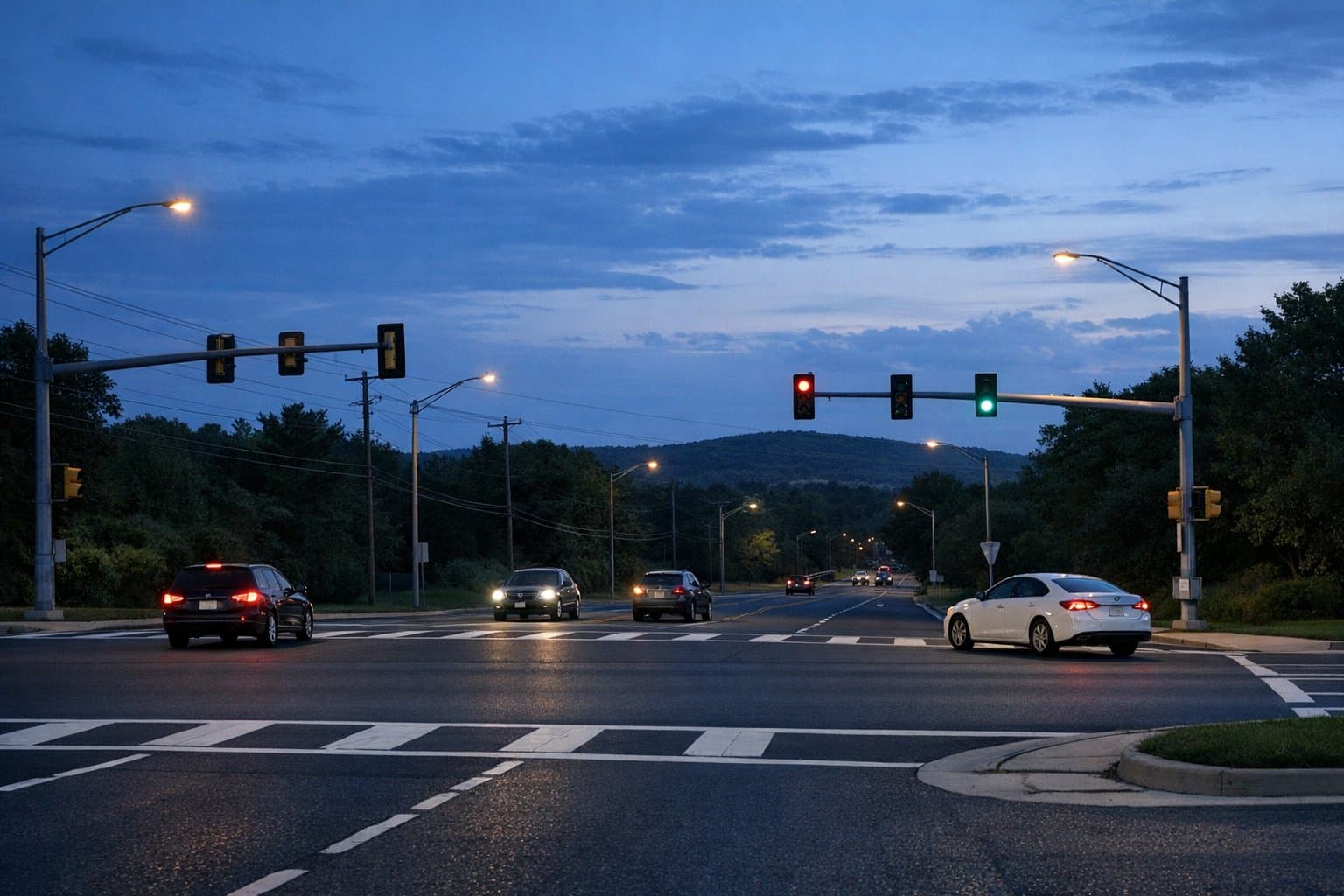
9. Unlit or Poorly Lit Nighttime Crossings
As established in the discussion on high beams, visibility is the cornerstone of safety. Intersections lacking adequate overhead lighting suffer from a disproportionately high frequency of severe nighttime crashes. The Mechanism of Failure: Without proper municipal illumination, a driver approaching at speed may fail to recognize that an intersection even exists. Furthermore, poorly lit intersections degrade a driver's ability to navigate complex turning movements safely and render pedestrians or cyclists in dark clothing virtually invisible until the moment of impact.
10. The Confusing or Misapplied Roundabout
Modern roundabouts are a marvel of traffic engineering; when deployed correctly, they reduce severe and fatal intersection crashes by up to 82 percent compared to traditional two-way stop intersections by forcing traffic to slow down and move in a uniform direction. However, misapplied roundabouts can create chaos. The Mechanism of Failure: When a roundabout is introduced to a high-volume urban area where local drivers are entirely unfamiliar with the yielding mechanics, the intersection often sees a massive spike in minor collisions. Drivers failing to yield to traffic already in the circle, or making abrupt lane changes within a multi-lane roundabout, result in frequent sideswipes and fender-benders. Case Study: The intersection of Cemetery Road and Main Street in Ohio. Despite the theoretical safety of roundabouts, this specific location recorded the highest total number of accidents in its region, largely attributed to driver unfamiliarity, high traffic volume, and proximity to schools.
The Data: A Snapshot of Danger
To visualize the scale of these hazards, we can examine the crash data aggregating the deadliest intersections across the country. The following tables highlight locations where poor design and high volume combine to create lethal outcomes.
Table: Select High-Fatality Intersections in the United States (FHWA/FARS Data)
| National Rank / Status | Intersection | Location | Primary Risk Factors / Crash Profile |
|---|---|---|---|
| Consistently Ranked Top 5 | Lalor Street & SR-129 | Trenton, New Jersey | Secondary high-speed road crossing a local road; 9 fatal crashes recorded from 2000-2019. |
| High Risk | Roosevelt Boulevard | Philadelphia, PA | Massive width, complex lanes, extreme pedestrian danger; 75+ fatal/severe crashes. |
| High Risk | Route 7 & Hickory Road | Niskayuna, New York | Speeding and geometric challenges; 5 fatal crashes recorded in recent yearly data. |
| High Risk | Flamingo Road & S. Decatur Blvd | Las Vegas, Nevada | High tourist volume, wide lanes, red-light running; saw a 33% increase in fatal crashes year-over-year. |
| High Risk | US-301 & Sun City Center Blvd | Hillsborough, Florida | Aging road users, wide arterial highway speeds, complex turning movements. |
Data sourced from National Highway Traffic Safety Administration FARS data and regional injury analyses.
Table: High-Risk Intersection Profiles in Orange County, CA
| Intersection | City | Key Risk Factors | Primary Accident Types |
|---|---|---|---|
| Beach Blvd & Chapman Ave | Stanton / Anaheim | Extremely high traffic volume, recognized as a historic hotspot for motorists, pedestrians, and cyclists. | Broadside crashes, pedestrian knockdowns. |
| SR-55 / SR-57 Interchange | Orange | Short off-ramps, heavy commercial truck volume, high-speed merges. | Rear-end pileups, sideswipes. |
| Katella Ave & State College | Anaheim / Orange | Stadium event traffic, retail chokepoints, distracted GPS navigation. | Multi-car pileups, rideshare loading accidents. |
| 17th Street & Fairview St | Santa Ana | School zone hazards, heavy cyclist and foot traffic. | Cyclist fatalities, pedestrian injuries. |
Data compiled from Orange County crash reports and regional legal analyses.
Part III: The Blueprint for Survival—Low-Cost Fixes Communities Can Advocate For
The staggering statistics surrounding intersection fatalities often lead to a sense of public fatalism—a belief that traffic deaths are simply the unavoidable cost of modern mobility. However, a growing movement among traffic safety experts, urban planners, and the FHWA insists otherwise. This is the foundation of the "Safe System Approach" and the "Vision Zero" movement, which operates on the core philosophy that traffic-related deaths and serious injuries are entirely preventable.
Vision Zero demands a paradigm shift: rather than relying solely on police enforcement and driver education, communities must engineer streets that account for human error, ensuring that when a mistake happens, the resulting kinetic energy is not lethal. Kansas City’s Vision Zero plan, for example, successfully elevated "Safe Intersections" as a core pillar, prioritizing physical redesigns to slow speeds and protect vulnerable users. Austin, Texas, recorded a 22% reduction in fatal and serious crashes at 22 high-crash intersections simply by implementing targeted safety upgrades.
For the protective parent or the neighborhood watch lead, the key to effective advocacy is knowing what to ask for. City councils often balk at multimillion-dollar infrastructure overhauls, but the FHWA has identified a suite of "Proven Safety Countermeasures"—highly effective, low-cost engineering treatments that can drastically reduce collision rates on a tight municipal budget.
Here are the most effective, low-cost fixes that communities can champion today.

Securing the Unsignalized and Rural Crossings
Addressing the danger of high-speed rural and unsignalized intersections relies entirely on maximizing driver awareness. The FHWA recommends a systemic approach, deploying multiple low-cost treatments simultaneously across an entire jurisdiction. Case studies from the Louisiana and South Carolina Departments of Transportation demonstrate that applying these combined fixes can reduce fatal and injury crashes by 27 percent at rural intersections, with a staggering benefit-cost ratio of 12:1.
- Doubled-Up and Oversized Signs: A standard stop sign is often not enough. Installing oversized "Stop" and advance "Stop Ahead" warning signs on both the left and right sides of the road approach guarantees that a driver's line of sight is captured, even if a large commercial truck is blocking the right-hand shoulder.
- Retroreflective Sheeting on Sign Posts: To combat the dangers of unlit intersections, engineers can wrap the entire vertical sign post in high-visibility retroreflective material. This simple, inexpensive fix draws the driver's eye toward the traffic control device long before the face of the sign itself becomes readable in the dark.
- Transverse Rumble Strips: For drivers suffering from highway hypnosis, tactile feedback is lifesaving. Machining shallow grooves into the pavement leading up to a stop sign provides an immediate auditory and physical vibration, shocking a distracted or drowsy driver back to attention and alerting them to the impending intersection.
- Vision Triangle Maintenance: Perhaps the lowest-cost solution available is aggressive vegetation management. Removing overgrown brush, low-hanging tree branches, and illegal parking near the corner restores crucial stopping and intersection sight distance, allowing drivers to safely assess gaps in cross-traffic.
Modernizing Urban Signalized Intersections
For high-volume urban and suburban grids, paint and signal programming can be just as effective as concrete.
- Retroreflective Signal Backplates: By adding a wide black backplate with a highly reflective yellow border around overhead traffic signal heads, traffic engineers can drastically improve the visibility of the signal. This creates contrast against bright, glaring skies or cluttered, neon-lit city backgrounds, reducing red-light running.
- Leading Pedestrian Intervals (LPI): This is a simple, zero-cost programming change to the traffic light's software. An LPI gives pedestrians a three- to seven-second head start to enter the crosswalk before vehicles traveling in the same direction are given a green light to turn. This simple head start establishes pedestrian right-of-way, places them squarely in the driver's field of vision, and has been proven to reduce vehicle-pedestrian crashes by up to 13 percent.
- Signal Re-timing for Clearance: Adjusting the duration of the yellow light and providing a brief "all-red" clearance interval gives vehicles caught in the middle of wide, complex intersections the necessary time to clear the conflict zone safely before cross-traffic is released.
Structural Modifications and Traffic Calming
When paint and timing are insufficient, low-cost structural modifications can physically force drivers to alter their behavior.
- Road Diets (Roadway Reconfiguration): A road diet converts a dangerous four-lane undivided roadway into a safer three-lane configuration (one lane in each direction with a dedicated center two-way left-turn lane). This inexpensive restriping project dramatically reduces speeding, provides dedicated space for left-turning vehicles (eliminating severe rear-end crashes in the fast lane), and shortens the crossing distance for pedestrians. Road diets can reduce overall vehicle crashes by up to 47 percent.
- Curb Extensions and Refuge Islands: Using inexpensive materials like flexible bollards, bright paint, or heavy planters, cities can extend the curb at intersections to shorten the pedestrian crosswalk and physically force turning vehicles to take corners at slower speeds. Constructing pedestrian refuge islands in the median allows individuals to cross wide, multi-lane streets one direction of traffic at a time, providing a safe haven if the light changes.
Table: Effectiveness and Cost of FHWA Proven Safety Countermeasures
| Engineering Countermeasure | Target Safety Issue Addressed | Estimated Effectiveness (Crash Reduction Factor) | Typical Implementation Cost per Intersection |
|---|---|---|---|
| Systemic Stop-Sign Upgrades (Oversized, Doubled, Retroreflective) | Recognition of stop-controlled intersections (day/night) | 10% - 27% reduction in fatal/injury crashes | 5,000 - 15,000 |
| Transverse Rumble Strips | Inattentive approach to stop signs | 28% reduction (CMF 0.72) | 3,000 - 10,000 |
| Upgraded Intersection Lighting | Nighttime visibility of geometry and vulnerable users | 25% - 50% reduction in night crashes | Varies widely by existing infrastructure |
| Leading Pedestrian Interval (LPI) | Pedestrian/turning vehicle conflicts | 13% reduction in related crashes | Low (Software reprogramming) |
| Road Diet Configuration | High speeds, left-turn rear-end conflicts | Up to 47% reduction in total crashes | Varies by corridor length |
Data aggregated from the FHWA Proven Safety Countermeasures and intersection safety analyses.
Part IV: The Human Element—Road Rage, Technology, and Community Connection
Infrastructure and vehicle engineering form the physical foundation of safety, but the ultimate, unpredictable variable remains human behavior. Frustration behind the wheel is a universal human experience, yet the escalation from mere annoyance to aggressive driving is a leading contributor to roadway fatalities. Understanding the psychology of the modern driver is essential for the tech-savvy commuter looking to survive the daily grind.
The Psychology of Aggressive Driving
Road rage is rarely triggered by major events; rather, it is ignited by relatively minor infractions that violate a driver's sense of spatial territory, time pressure, or perceived etiquette. According to comprehensive research by the AAA Foundation for Traffic Safety and other sociological studies, the most significant triggering events for road rage include aggressive tailgating (cited in 62 percent of cases) and inappropriate headlight flashing (cited in 60 percent of cases).
When a driver feels deliberately obstructed in the fast lane, blinded by an oncoming vehicle's high beams, or endangered by a sudden cut-off, the psychological enclosure of the vehicle provides a dangerous sense of anonymity. This isolation often encourages a retaliatory, aggressive response—a phenomenon known as vigilantism, where an otherwise responsible driver decides to "teach a lesson" to an aggressive driver by returning the aggression. To avoid sliding into this mindset and to understand what crosses the line into criminal behavior, it helps to know the difference between negligence, recklessness, and road rage, as explained in our guide to spotting dangerous driving and protecting yourself.
The National Safety Council (NSC) data indicates that dangerous driving behaviors born of this frustration—including speeding, improper lane usage, and failure to yield right-of-way—are involved in a massive percentage of fatal crashes. From slamming on the brakes unnecessarily (brake-checking) to actively steering another vehicle onto the shoulder, these aggressive maneuvers turn ordinary road sections into high-risk combat zones.
The Promise of Vehicle-to-Vehicle (V2V) Communication
Automotive engineers and federal traffic safety experts point to advanced technology, specifically Vehicle-to-Vehicle (V2V) communication, as the definitive future of crash avoidance and road rage mitigation. Utilizing a wireless protocol similar to Wi-Fi known as Dedicated Short Range Communications (DSRC), V2V technology allows vehicles to wirelessly exchange critical telemetry data—such as speed, trajectory, brake status, and location—with similarly equipped vehicles up to 1,000 feet away.
This technology is specifically designed to combat human error at the dangerous intersections discussed in Part II. Applications like Intersection Movement Assist (IMA) and Left Turn Assist (LTA) can calculate complex approach vectors in real time, actively warning a driver via visual displays or seat vibrations if it is unsafe to enter a blind, skewed intersection. Furthermore, by providing 360-degree situational awareness and optimizing traffic flow, researchers estimate V2V can reduce congestion delays by 20 to 30 percent, thereby mitigating the dense traffic conditions that most frequently trigger road rage.
However, the reality of V2V technology is that it relies on massive market penetration to be effective; vehicles can only communicate if both are equipped with compatible hardware. It will take decades for the legacy fleet of older cars to cycle out of the national network. Until then, drivers require an immediate, accessible bridge for roadway communication.
The Rise of Human Media™ and Driver-to-Driver Alerts
To fill the massive void between isolated human drivers and future autonomous systems, innovative, community-focused technology platforms are emerging as powerful safety tools. This is the domain of Carszy, a modern driver-to-driver communication and community safety platform that is redefining how we interact on the road.
By utilizing license plates as secure, unique identifiers, Carszy connects people on the road, shifting the paradigm from the toxic, doom-scrolling nature of traditional "Social Media" to the real-world, life-saving impact of "Human Media™." Here is a tech review breakdown of how these features empower the protective parent and the neighborhood watch advocate:
- De-escalation Through Direct Communication: As noted earlier, many aggressive driving incidents stem from simple misunderstandings—a driver unaware that their high beams are blinding oncoming traffic, or a commuter oblivious to the fact that their taillight is out. Carszy’s License Plate Messaging feature allows drivers to send secure, anonymous texts or calls to other motorists using just their plate number. Sending a quick, polite alert like "lights off," "tailgate open," or "dog in hot car" pierces the dangerous anonymity of the highway. By allowing for courteous corrections rather than angry retaliation, this tool actively defuses road rage triggers before they escalate.
- Enhancing Emergency Response Times: Every single second counts following a severe collision. Studies show that a delay of even a few minutes in Emergency Medical Services (EMS) arrival significantly increases the likelihood of a fatality. Real-time, crowdsourced citizen reporting via mobile platforms ensures that accidents, road hazards, and dangerous driving behaviors are logged immediately. This community-driven data stream drastically reduces the critical crash-to-notification time, expediting EMS dispatch and potentially saving lives. For bystanders who want a simple script to follow in these moments, our bystander crash response playbook walks through safe steps and smart documentation.
- Mobilizing the Community with VOIS™: Hit-and-run collisions are notoriously difficult for law enforcement to solve due to a severe lack of actionable evidence at the scene. Platforms integrating features like VOIS™ (Vehicle of Interest Search) turn the everyday driving public into a highly effective, real-time neighborhood watch. When a vehicle is involved in a critical incident—such as a hit-and-run, an abduction, or trafficking—community-driven alert networks can crowdsource sightings instantly. This real-time mobilization drastically reduces law enforcement response times and holds dangerous drivers accountable.
- Privacy First: For the tech-savvy driver, privacy is a paramount concern. Carszy addresses this by maintaining privacy-focused, US-based servers, ensuring that location data and messaging histories serve the community's safety without compromising individual security or enabling tracking.
Research explicitly validates the effectiveness of this crowdsourced, citizen-led safety model. An extensive evaluation of user-reported "danger spots" in Germany found that everyday road users—who navigate their local streets daily—can highly accurately identify traffic hazards, poor visibility zones, and structural deficits long before they result in a severe crash and appear in official police collision statistics. Blending these subjective citizen reports with official data creates powerful hazard maps that allow communities to preemptively address dangerous intersections. This is the same philosophy behind Carszy’s near-miss and sentiment reporting, explored further in our article on turning near misses into actionable safety data.
Part V: The Playbook—How Communities Can Advocate for Real Change
Equipped with a deep understanding of headlight science, intersection engineering, and the power of technological connectivity, everyday drivers, parents, and neighborhood watch leads are perfectly positioned to demand safer streets. Transforming a dangerous intersection into a secure community asset requires structured, data-driven advocacy.
The most successful community safety initiatives follow the principles laid out in the Vision Zero Citizens Action Guide. To advocate effectively, communities should execute the following playbook:
- Gather Hyper-Local Data: Advocacy begins with irrefutable evidence. Citizens should utilize digital reporting tools and platforms to systematically log near-misses, aggressive driving incidents, and pedestrian hazards at specific intersections. Presenting a city council with a data set demonstrating a consistent pattern of red-light running or high-beam glare at a specific corner is far more persuasive than relying on anecdotal complaints. Carszy’s reporting tools, combined with the strategies in our near-miss hotspot mapping guide, give communities a simple way to build that evidence.
- Conduct Participatory Mapping and Safety Audits: Neighborhood associations should organize "safety walks" or utilize toolkits like the Institute of Transportation Engineers' Unsignalized Intersection Improvement Guide (UIIG) to document specific infrastructural failures. Is vegetation blocking the stop sign? Is the crosswalk paint faded? Are the intersection angles dangerously skewed? Document everything with photographs and GPS coordinates.
- Propose Specific, Low-Cost Solutions: When engaging city council members, traffic engineers, or the local Department of Transportation, do not just complain about a problem—offer the solution. Present the FHWA Proven Safety Countermeasures detailed in this report. Requesting a $5,000 upgrade for doubled-up retroreflective signs or a simple software re-timing for a Leading Pedestrian Interval is a highly achievable political victory compared to demanding a multimillion-dollar overpass.
- Foster a Culture of Accountability: Road safety is intrinsically linked to community culture. By hosting transportation safety roundtables, utilizing community driver-to-driver alert networks, and encouraging strict adherence to safe driving practices, neighborhoods can actively deter reckless behavior before it results in a tragedy. Local examples like the Orange County community safety hub show how residents, agencies, and tech tools can work together to shift norms.
Driving the Future of Safety Together
The hazards of the modern road—from the blinding glare of improperly used high beams to the geometric chaos of multi-leg intersections and the psychological stress of road rage—are not insurmountable facts of nature. They are mechanical and behavioral challenges that can be systematically mitigated through education, intelligent engineering, and unwavering community vigilance.
As everyday drivers, we must take personal responsibility for mastering our vehicle's lighting systems, reserving our high beams for dark, open roads and maintaining strict discipline during adverse weather to protect the vision of our fellow motorists. Concurrently, we must rally our communities to identify our most dangerous intersections, utilizing data and civic engagement to demand proven, low-cost engineering countermeasures from our local authorities.
Ultimately, the most powerful tool for roadway safety is human connection. By breaking down the barriers of vehicular isolation and fostering real-time accountability, we can drastically reduce road rage, expedite emergency responses, and create secure, thriving neighborhoods. To join the movement for secure, community-driven road safety and take an active role in protecting your streets, download the Carszy app to stay connected with fellow drivers at carszy.com. For a broader safety roadmap that ties these ideas together—from emergency kits to community reporting—explore our overview of modern driver safety strategies.