The Illusion of Invincibility: Demystifying Car Safety Tech and Fixing the Deadliest Intersections
The modern driving experience is defined by a paradox. The automobiles navigating today's roadways are equipped with the most advanced, computationally powerful safety systems in the history of engineering, yet traffic fatalities remain a persistent and tragic crisis. Drivers are cocooned in high-tensile steel and surrounded by networks of sensors capable of making split-second decisions, creating a pervasive illusion of invincibility. However, the raw data tells a much darker story. In recent years, the number of pedestrians struck and killed on American roads reached a 40-year high, with 7,522 lives lost in a single year—an average of more than 20 deaths per day.
Concurrently, intersections—the critical nodes where commuter paths collide—continue to account for roughly one-quarter of all traffic fatalities and nearly half of all traffic injuries nationwide.
The disconnect between advanced automotive technology and the reality of highway mortality stems from two primary failures. First, there is a profound lack of understanding regarding what vehicle safety systems actually do. When advanced features activate in an emergency, drivers often misinterpret the mechanical feedback, leading to catastrophic overcorrections.
Second, the infrastructure supporting these advanced vehicles is deeply flawed. The geometric patterns of modern roadways, relying on mid-century urban planning that prioritized vehicular speed over human life, actively invite collisions.
Addressing this crisis requires a comprehensive shift in how communities approach road safety. It demands a nuanced technical understanding of the vehicle dynamics occurring underneath the floorboards. It requires neighborhood watch leads and everyday commuters to recognize the architectural traps of dangerous intersections so they can advocate for proven, low-cost geometric fixes. Finally, it necessitates an evolution in emergency response. With traditional dispatch systems strained to the breaking point, the future of public safety relies on empowering the community, leveraging driver-to-driver communication to fill the gaps left by municipal infrastructure.
This exhaustive report breaks down the mechanical truths behind the safety features most often misunderstood, exposes the ten most dangerous intersection patterns haunting local neighborhoods, provides a tactical playbook for community infrastructure advocacy, and explores how modern technology is shifting the power of public safety directly into the hands of the people. For a broader, practical overview of daily driving risks and preparation, you can also explore a modern driver’s safety guide like Road Ready: The Modern Driver's Guide to Staying Safe, which pairs well with the deeper engineering focus in this article.
Part 1: The Alphabet Soup of Survival: Deconstructing Vehicle Safety Tech
Modern automobiles operate via complex networks of sensors monitoring everything from wheel speed to steering angle, intervening with blistering speed when human reactions fall short. Yet, the human element remains the weakest link. When drivers do not understand the mechanical feedback of their own vehicles, they often fight the very systems designed to save them. Maximizing road safety requires an intimate understanding of the holy trinity of modern vehicle dynamics: Anti-lock Braking Systems (ABS), Traction Control Systems (TCS), and Electronic Stability Control (ESC).

The Mechanics and Myths of Anti-lock Braking Systems (ABS)
Before the widespread adoption of ABS, emergency braking was a terrifying gamble governed entirely by the limits of human reflexes. In a panic scenario, slamming on the brake pedal would cause the brake pads to clamp down fully on the rotors, locking the wheels. Once a wheel locks and begins skidding across the pavement, static friction is broken. The vehicle transforms into an unguided projectile, completely robbing the driver of the ability to steer.
The Anti-lock Braking System revolutionized vehicle safety by directly addressing this failure point. The architecture of ABS consists of highly sensitive wheel speed sensors, hydraulic pumps, precision valves, and a central electronic controller. When intense braking is initiated, the controller continuously monitors the rotational speed of each individual wheel. If the algorithm detects that one or more wheels are rapidly decelerating and on the verge of locking up, the controller immediately signals the hydraulic valve to reduce brake pressure to that specific wheel, allowing it to continue rolling and maintain traction. The moment the wheel accelerates slightly, the hydraulic pump instantly pressurizes the brake line again.
This micro-management of hydraulic brake pressure occurs with astonishing rapidity. The cycle of releasing and reapplying the brakes can repeat up to 15 times per second, ensuring the vehicle sheds speed without ever breaking traction. The maintenance of this system is highly specialized; bleeding an ABS system often requires a pressure bleeder and a bi-directional scanner to ensure the internal accumulators are fully purged of air, as any air in the lines can severely compromise the system's reaction time. When operating correctly alongside Automatic Emergency Braking (AEB) systems, these braking technologies have been shown to reduce front-to-rear crashes by an astounding 49% to 52% across modern vehicle model years.
Real-World Capabilities and Limitations The primary and most crucial function of ABS is to allow the driver to maintain steering control during maximum deceleration. Because the wheels continue to rotate rather than skid, the driver can swerve around an obstacle—such as a stopped car, a pedestrian stepping into a crosswalk, or highway debris—while still shedding speed as quickly as physics will permit.
However, the most dangerous and pervasive myth regarding ABS is that it automatically guarantees a shorter stopping distance in all environments. While ABS generally optimizes stopping distances on dry and wet asphalt, it can significantly increase stopping distances on loose surfaces like deep snow, heavy gravel, or dirt. On a loose surface, a locked wheel will plow into the material, building up a physical wedge of snow or gravel in front of the tire that acts as a chock to bring the vehicle to a halt. ABS prevents this wedge from forming by keeping the tire rolling over the loose material, thereby extending the stop. Furthermore, ABS cannot defy the laws of momentum; excessive speed or tailgating will still result in a collision, regardless of the technology. To see how ABS and other systems perform when roads turn slick or flooded, it helps to pair this knowledge with real-world bad-weather strategies like those in Reducing Road Collisions: Strategies for Safer Communities.
The Correct Driver Response When ABS activates, the sensory feedback is intense and frequently alarms uninitiated drivers. The driver will feel a violent, rapid vibration or pulsation vibrating through the brake pedal, accompanied by a loud grinding, groaning, or buzzing noise from the hydraulic pumps.
The driver must adhere to specific protocols during an ABS activation:
- Stomp and Stay: Firm, continuous, and unyielding pressure must be applied to the brake pedal. The driver must push through the mechanical vibration and let the computer manage the cadence braking. Easing off the pedal reduces the system's effectiveness.
- Do Not Pump the Brakes: Pumping the brakes is a legacy technique from the pre-ABS era. Pumping the pedal now will only confuse the electronic controller, essentially turning the system on and off and significantly reducing the vehicle's ability to stop.
- Look and Steer: The driver must keep their eyes focused strictly on the escape route rather than the obstacle, steering smoothly toward the open space.
Traction Control Systems (TCS): Managing Longitudinal Grip
If ABS is designed to manage the forces of deceleration, the Traction Control System is its operational counterpart, tasked with managing the forces of acceleration.
The architecture of TCS utilizes the exact same wheel speed sensors as the ABS. When the accelerator pedal is pressed, the system monitors the rotational speed of the driven wheels. If the controller detects that a driven wheel is spinning significantly faster than the vehicle's actual ground speed—meaning the tire has lost its grip and is spinning uselessly on slick pavement, ice, or mud—the TCS immediately intervenes.
Traction control accomplishes this intervention through two primary mechanisms. First, it selectively applies the ABS brake to the specific spinning wheel. This slows the spinning wheel down and forces the vehicle's differential to route engine power to the opposite wheel, which hopefully has grip on the road surface. Second, the system electronically restricts engine power, overriding the driver's input and cutting the throttle regardless of how hard the accelerator pedal is depressed.
Real-World Capabilities and Limitations
Traction control is exceptionally effective at keeping a vehicle moving forward in a straight line on slippery surfaces. It prevents fishtailing when accelerating away from a stoplight in heavy rain and helps maintain forward momentum when transitioning from dry pavement to an unexpected patch of black ice. However, TCS does not increase the physical grip limit of the tires. It merely optimizes the grip that is currently available. If a vehicle enters a corner carrying excessive speed, TCS will not prevent lateral sliding; it is strictly concerned with longitudinal (forward) slip during acceleration.
The Correct Driver Response In the vast majority of daily driving scenarios, if engine power suddenly cuts or the yellow TCS indicator light flashes on the dashboard while accelerating, the driver should simply ease off the accelerator slightly and maintain a straight steering wheel until grip is restored.
There is, however, one specific scenario where Traction Control should be manually disabled. If a vehicle is deeply stuck in heavy snow, deep mud, or loose sand, wheel spin is actually required to maintain momentum and allow the tire treads to clear themselves of the packed material. Because TCS will sense the slipping and ruthlessly cut engine power, the vehicle will become completely bogged down. By turning TCS off—usually via a dashboard button featuring an icon of a car with squiggly lines—the driver allows the tires to spin freely, enabling them to "rock" the vehicle out of the rut. Once freed and back on solid ground, the system must be immediately reactivated. It should also be noted that in automatic and manual vehicles, putting the car in neutral removes all power from the wheels, rendering traction control interventions moot as there is no forward torque to manage.
Electronic Stability Control (ESC): The Invisible Hand of Vehicle Dynamics
Electronic Stability Control—often marketed under proprietary names such as Vehicle Dynamic Control, AdvanceTrac, or Dynamic Stability Control—is widely considered the most significant automotive safety advancement since the three-point seatbelt. Analysis from the National Highway Traffic Safety Administration estimates that ESC reduces fatal single-vehicle rollovers by 40% to 56%, and reduces loss-of-control crashes by a substantial margin across all vehicle classes, including heavy trucks and commercial vehicles.
The ESC acts as the master conductor of the vehicle's dynamic safety net. It incorporates the wheel speed sensors utilized by the ABS and TCS, but adds three crucial layers of spatial intelligence: a steering angle sensor, a yaw rate sensor, and a lateral acceleration sensor. The steering angle sensor tracks exactly where the driver is attempting to point the vehicle. The yaw rate sensor monitors the vehicle's rotation about its vertical axis, determining if the car is spinning. The lateral acceleration sensor measures sideways G-forces, detecting if the vehicle is sliding laterally.
The central ESC computer constantly compares two vital data points: the driver's intended path (derived from the steering wheel angle) and the vehicle's actual path (derived from the yaw and lateral acceleration sensors).
If these two paths diverge, the vehicle is actively skidding. If the front tires lose grip and the car pushes forward instead of turning—a condition known as understeer—or if the rear tires lose grip and the car begins to spin out—known as oversteer—the ESC steps in. It corrects these violent geometric deviations by selectively applying hydraulic braking pressure to individual wheels. For instance, if the rear of the car begins to swing out to the right during an oversteer event, the ESC will intensely brake the outer left front wheel. This creates an immediate counter-rotational force that snaps the rear of the car back into linear alignment.
Real-World Capabilities and Limitations ESC is unparalleled at saving drivers from sudden evasive maneuvers. Consider a scenario where a driver swerves violently to avoid debris on a dark highway, and then immediately swerves back to avoid entering oncoming traffic. In older vehicles lacking ESC, this maneuver induces a "pendulum effect," where the weight transfer of the vehicle exceeds the grip of the tires, almost certainly resulting in a catastrophic spin or rollover. ESC snuffs out the pendulum effect by dynamically braking specific corners of the car to forcefully stabilize the chassis.
However, like all mechanical systems, ESC is bound by the unforgiving laws of physics. If a driver takes a sweeping highway curve at 90 miles per hour when the physical limit of the tires is 50 miles per hour, no amount of individual wheel braking will generate the grip required to keep the vehicle on the asphalt. The system also completely relies on functional, properly inflated tires; if the tires are bald or severely under-inflated, the system's braking interventions will fail to translate into corrective force.
The Correct Driver Response When ESC activates, the driver will feel the car jerk abruptly as individual brakes are applied independently. The ABS hydraulic pump will grind audibly, the dashboard warning light will flash wildly, and the engine control module will frequently cut throttle power entirely.
The single most critical rule for the driver during an ESC intervention is to look and steer exactly where they want the vehicle to go. Because the ESC specifically reads the steering angle sensor to determine the intended path and calculate its life-saving corrections, the driver must point the steering wheel toward safety.
Panic frequently causes drivers to wildly yank the steering wheel back and forth. This overcorrection severely confuses the ESC system, as the intended path keeps violently changing, forcing the computer to constantly recalculate and alter its braking interventions. The driver must keep their steering inputs as smooth and deliberate as possible, trusting the microprocessor to drag the vehicle back into alignment.
| Safety System | Primary Function | Key Sensor Array | Correct Driver Action During Activation |
|---|---|---|---|
| ABS (Anti-lock Brakes) | Prevents wheel lock-up to maintain steering control during maximum deceleration. | Wheel speed sensors. | Apply maximum continuous pedal pressure, hold through the vibration, steer away from danger. |
| TCS (Traction Control) | Prevents wheel spin during acceleration to maximize forward momentum on slick surfaces. | Wheel speed sensors, throttle position. | Maintain steady throttle. Disable manually only when deeply stuck in snow, mud, or sand. |
| ESC (Electronic Stability) | Prevents skids, spin-outs, and rollovers by correcting discrepancies between intended and actual path. | Yaw rate, lateral acceleration, and steering angle sensors. | Look toward the escape route, point the steering wheel precisely there, and absolutely avoid wild overcorrection. |
Part 2: The Architecture of Disaster: Analyzing the 10 Deadliest Intersection Patterns
While understanding vehicle safety technology is the first line of defense, even the most advanced Electronic Stability Control system cannot compensate for fundamentally flawed infrastructure. Society frequently operates under the assumption that an intersection is inherently "safe" simply because it is regulated by a traffic light or a stop sign. However, crash statistics reveal a terrifying consistency in the architectural designs of dangerous roadways. If you want a shorter companion guide focused only on where crashes cluster—and what to do about it—see the breakdown of the ten deadliest U.S. intersection types and quick fixes, which echoes many of the designs explored here.
Data compiled by safety advocacy groups such as Smart Growth America, alongside federal figures from the NHTSA, prove that a staggering percentage of pedestrian deaths and severe vehicle collisions share common geometric characteristics: multiple wide lanes, high speed limits, and vast crossing distances. A comprehensive study of pedestrian fatalities highlighted that an alarming 97% of fatal strikes occurred on roads featuring three or more lanes, while 70% of fatal locations forced pedestrians to cross five or more lanes to reach the opposite sidewalk. Furthermore, 75% of these fatal sites had speed limits exceeding 30 mph—a velocity at which the likelihood of a pedestrian surviving a strike plummets dramatically.
This crisis is not distributed equally. Vulnerable populations bear the brunt of these design failures. Research indicates that Black and Native Americans, older adults, and individuals walking in low-income communities die at significantly higher rates and face higher levels of risk compared to the broader population, largely due to decades of infrastructure disinvestment and the routing of high-speed arterials through marginalized neighborhoods. The Memphis, Tennessee metropolitan area, for example, has seen its pedestrian death rate nearly triple, reaching 5.14 deaths per 100,000 people, driven by sprawling, high-speed road design. For a more human-centered look at how these design choices affect people walking and biking, especially in marginalized neighborhoods, the analysis in Pedestrian and Cyclist Safety: A Human-Centric Approach provides powerful context.
By analyzing crash cluster data from notorious traffic corridors across the country—from Orange County, California, to Harris County, Texas, to state highways in New Jersey—analysts can identify the distinct geometric and operational patterns that make certain intersections a nightmare for everyday commuters.

1. The High-Speed Arterial Multi-Lane Crossing (The "Frogger" Pattern)
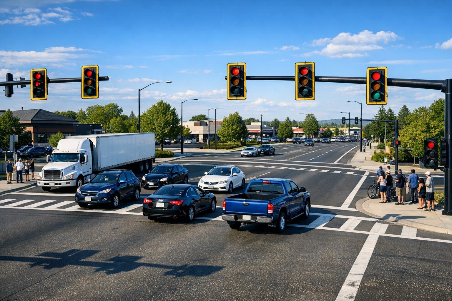
This design is arguably the most lethal intersection pattern in the United States. These are massive, sprawling junctions where two major arterial roads—often boasting three or four lanes in each direction—collide. Speed limits on these corridors are typically 45 mph or higher. The sheer physical width of the intersection means it takes a significant amount of time for a vehicle or pedestrian to clear the conflict zone. Drivers attempting to beat long yellow lights frequently accelerate to speeds exceeding 55 mph, resulting in devastating, highly fatal T-bone collisions.
- Regional Example: The intersection of US-19 and Tampa Road in Pinellas County, Florida, is notorious for high speeds and massive congestion, ranking among the top crash sites regionally. Similarly, the intersection of Edinger Ave & Beach Blvd in Huntington Beach, CA, sees massive multi-lane accident volumes.
2. The Short Freeway On/Off Ramp Surface Merge
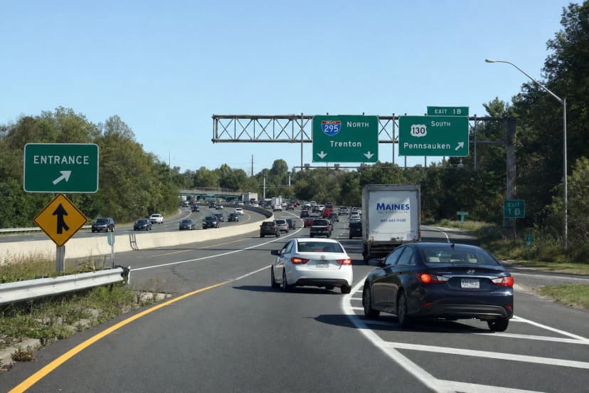
When freeway traffic traveling at 70 mph is suddenly routed onto a local surface street via short, poorly designed off-ramps, vehicular chaos inevitably ensues. These intersections force rapid, chaotic deceleration while mixing high-speed exiting traffic with slower local commuter traffic. This leads to extreme congestion, aggressive lane changes, and frequent rear-end and sideswipe accidents.
- Regional Example: The SR-55/SR-57 Interchange area near Chapman Avenue in Orange, CA. Widely considered one of the most dangerous stretches in the city, its poor ramp geometry dumps heavy commercial and industrial traffic directly onto surface streets, resulting in constant rush-hour pileups.
3. The Historic Urban Gridlock Clash
Many historic downtowns and town squares feature intersections originally designed for 1950s traffic levels that are now structurally buckling under modern commuter and delivery volumes. These intersections often lack dedicated left-turn lanes or specific turn signals. This architectural deficiency forces drivers to inch nervously into the intersection and execute blind, aggressive left turns through minimal gaps in heavy oncoming traffic. This specific design failure is highly correlated with severe T-bone crashes and catastrophic pedestrian knockdowns.
- Regional Example: Chapman Avenue & Main Street in Old Towne Orange, CA. The historic plaza handles massive east-west vehicle flow that aggressively conflicts with heavy pedestrian foot traffic, leading to frequent left-turn collisions.
4. The "Strode" Retail Corridor Chokepoint
A "strode" is an urban planning term describing a dangerous hybrid between a street (designed for complex local interactions, pedestrians, and destinations) and a road (designed for high-speed, long-distance transit). Intersections situated along retail strodes are chaotic environments. They are characterized by multiple curb cuts (driveway entrances) located immediately adjacent to the main intersection, confused shoppers navigating via GPS, large delivery trucks blocking critical sightlines, and constant stop-and-go movements.
- Regional Example: The City Drive & State College Boulevard near the Outlets in Orange, CA. A toxic mix of tourists, delivery vehicles, and complex parking lot entry/exit points leads to constant distracted-driving rear-end collisions.
5. The Pedestrian-Heavy Transit Hub
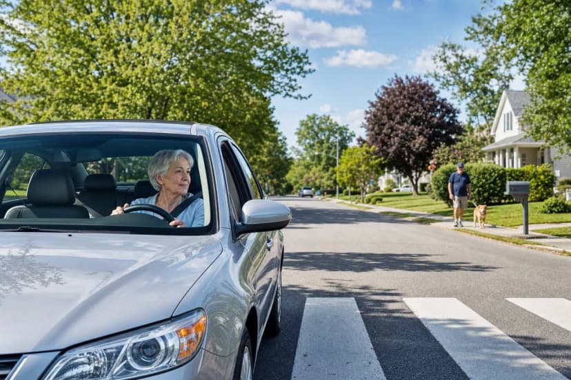
Intersections located near major public transit stops, university campuses, or large shopping malls see immense volumes of pedestrian and cyclist traffic forced to directly interact with impatient motor vehicle traffic. Right-turning vehicles, focused heavily on finding a gap in vehicular traffic, frequently fail to check blind spots for pedestrians already established in the crosswalk, leading to tragic, low-speed but highly fatal strikes.
- Regional Example: Bay Drive and Meder Street in Santa Cruz, adjacent to the UCSC campus, where tragic motorcycle and pedestrian collisions have sparked demands for traffic pattern overhauls. Similarly, the intersection of Route 9 & Speen Street in Massachusetts is flagged for severe high-pedestrian traffic dangers.
6. The Wide-Radius Slip Lane
Slip lanes are dedicated right-turn lanes separated from the main intersection by a small concrete traffic island. While engineers utilize them to keep traffic moving efficiently, their physical design often features wide, sweeping curb radii. This sweeping geometry actively encourages drivers to take the turn at 20 to 30 mph rather than coming to a complete stop. This severely increases the risk to pedestrians who must cross that active slip lane to reach the island. The driver's head is typically turned hard left looking for a gap in oncoming traffic, causing them to completely ignore the pedestrian stepping off the curb directly to their right.
7. The Blind Sweeping Curve Intersection
Rural or suburban intersections located at the apex or exit of a sweeping horizontal curve present severe perceptual challenges. Drivers approaching the intersection have heavily restricted sightlines due to the curvature of the road, encroaching foliage, or shifting topography. Vehicles attempting to pull out from the stop sign cannot accurately gauge the speed or distance of oncoming traffic, resulting in catastrophic broadside crashes.
8. The Mega-Intersection with Long Signal Cycles
To accommodate the sheer volume of traffic on major arterials, municipal engineers often program traffic light cycles to last up to three minutes. This immense delay breeds extreme driver frustration. When the light finally turns green, drivers accelerate aggressively to escape the junction. More dangerously, when the light turns yellow, drivers are so desperate to avoid another agonizing three-minute wait that they invariably accelerate to run the red light, causing severe, high-speed right-angle crashes.
9. The Unprotected Multi-Lane Left Turn
These high-stress intersections require drivers to yield and turn left across two or three lanes of oncoming traffic without the protection of a dedicated green arrow. It is incredibly difficult for the human brain to accurately process and judge the speed and distance of multiple vehicles approaching simultaneously across different lanes. A momentary miscalculation in closing speed results in highly fatal side-impact collisions.
- Regional Example: The junction of Harlem and Madison in the Chicago metro area, an intersection noted by the Active Transportation Alliance for its lack of designated left-hand turn lanes, contributing heavily to a high rate of pedestrian and vehicle collisions.
10. The Rural High-Speed Stop-Controlled Junction
Two-lane rural highways frequently feature crossroads controlled only by a stop sign on the minor intersecting road. Traffic on the main road does not stop and typically travels at speeds between 55 and 65 mph. The primary failure at these intersections is one of "recognition"—drivers on the minor road either fail to see the stop sign entirely due to a lack of visual cues in the rural environment, or they stop but fail to accurately perceive the extreme speed of the approaching mainline traffic, pulling out directly into a catastrophic, high-kinetic-energy impact.
Analyzing Regional Data: The Deadliest Intersections in the United States
Crash data reveals that certain intersections repeatedly emerge as statistical outliers for fatalities and severe injuries. The following table highlights some of the most dangerous intersections nationally based on fatal crash reporting, illustrating the lethal consequences of flawed intersection geometry.
| Rank | Intersection Location | City / County | State | Number of Fatal Crashes |
|---|---|---|---|---|
| 1 | Street Rd. (SR-132) and Knights Rd. (SR-2019) | Bucks County | Pennsylvania | 6 |
| 2 | US-83 and 247th Ave. (SR-23) | Ward County | North Dakota | 6 |
| 3 | SR-13 and SR-123 | Polk County | Missouri | 6 |
| 4 | Fm866 and SR-32 | Ector County | Texas | 7 |
| 5 | Deen Still Rd E and SR-33 | Polk County | Florida | 7 |
| 6 | Blue Diamond Rd and S El Capitan Way | Las Vegas | Nevada | 6 |
Note: Data aggregated from multiple fatal crash analyses.
The Orange County Crisis: A Microcosm of Design Failure
To understand how these design patterns manifest in a dense, high-traffic environment, one must look at Orange County, California. The county sees over 223 traffic deaths and 12,500 injury crashes annually, with cities like Santa Ana, Anaheim, and Costa Mesa consistently ranking highest for total crash frequency. From 2010 to 2019, nearly 60,000 traffic collisions occurred at Orange County intersections alone, resulting in 328 deaths.
| High-Risk Intersection | City | Primary Risk Factor | Accident Volume Context |
|---|---|---|---|
| Newport Blvd & Victoria St | Costa Mesa | Ranked #1 Most Dangerous locally. | High traffic volume, multi-lane crossings. |
| Beach Blvd & Ball Rd | Anaheim | Pedestrian hazards, high speeds. | 53+ severe accidents documented. |
| 17th St & Fairview St | Santa Ana | Cyclist fatalities, aggressive left turns. | Multiple cyclist/pedestrian severe injuries. |
| Edinger Ave & Beach Blvd | Huntington Beach | High traffic volume, massive crossing distance. | 55+ crashes annually. |
The data proves that driver error is deeply compounded by intersection geometry. Without physical changes to the roadway environment, behavior modification alone is insufficient to stem the tide of traffic violence. For a driver’s-eye view of how to spot and avoid these danger patterns on your own commute, and how to respond if you see chaos unfolding, resources like Reducing Traffic Violence with Roundabouts and Safe Tech offer a practical playbook that complements the analysis in this section.
Part 3: Tactical Urbanism: A Playbook for Low-Cost Safety Enhancements
Faced with dangerous local infrastructure, communities often feel powerless. Completely redesigning and rebuilding a major intersection can cost tens of millions of dollars and require a decade of environmental reviews, right-of-way acquisitions, and engineering studies. However, the Federal Highway Administration (FHWA) and organizations like the National Association of City Transportation Officials (NACTO) have empirically proven that massive safety gains can be achieved rapidly through cheap, fast, "low-cost safety improvements".
Neighborhood watch advocates and local safety boards do not have to wait for a total road overhaul. By understanding Crash Modification Factors (CMF)—a rigorous statistical metric used by traffic engineers to estimate the percentage of crash reduction a specific treatment will yield—citizens can intelligently petition their city councils and departments of transportation for immediate, proven fixes. A CMF less than 1.0 indicates a reduction in crashes; for example, a CMF of 0.85 means the treatment yields a 15% reduction in target crashes. If you’ve ever had a serious near-miss at an intersection and wondered how to turn that close call into change, the five-step plan in Effective Safety Strategies After Near-Miss Collisions walks through how everyday drivers can feed these observations into real improvements.
Enhancing Visibility and Recognition
At many intersections, the fundamental problem is that drivers simply cannot see the intersection or the traffic signal in time to react. This is particularly lethal at night, in fog, or in visually complex environments like a retail corridor saturated with neon signs and competing light sources.
Retroreflective Traffic Signal Backplates This is arguably one of the most effective, highest-ROI safety improvements available to any municipality. A signal backplate is the dark, rectangular frame mounted around the traffic light housing. By simply adding a 3-inch border of highly visible, retroreflective yellow tape around the perimeter of the backplate, the signal becomes immensely conspicuous. It stands out sharply against background visual clutter and, crucially, remains highly visible in the glare of headlights during regional power outages, providing a vital visual cue to drivers. Federal data demonstrates that this simple tape application yields a robust 15% reduction in total intersection crashes. Certain state studies, such as those conducted in Kentucky, have shown an aggregate crash reduction of nearly 19.6%, with right-angle crashes dropping by over 44%.
Transverse Rumble Strips and Warning Pavement Markings For dangerous, high-speed rural stop-controlled junctions where drivers frequently blow through intersections due to a lack of recognition, auditory and tactile warnings are essential. Milling transverse rumble strips into the asphalt across the approach lane physically vibrates the vehicle, snapping a fatigued or distracted driver back to high alert. When combined with "Stop Ahead" pavement markings painted directly onto the roadway, this approach drastically reduces crashes. According to the FHWA, transverse rumble strips carry a CMF of 0.72, netting a massive 28% reduction in crashes, while pavement markings yield a 15% reduction.
| Countermeasure for Rural Stop-Controlled Intersections | Safety Issue Addressed | Estimated Crash Modification Factor (CMF) | Typical Implementation Cost Range |
|---|---|---|---|
| "Stop Ahead" Pavement Markings | Recognition of stop location during day/night. | 0.85 (15% Crash Reduction) | Less than $1,000 |
| Transverse Rumble Strips | Recognition of intersection, speed reduction. | 0.72 (28% Crash Reduction) | 3,000 to 10,000 |
| Basic Sign Enhancements (Larger/Reflective) | Recognition of stop-controlled intersection. | 0.90 (10% Crash Reduction) | 5,000 to 8,000 |
Physical Traffic Calming (Tactical Geometry)
While signs and tape address visibility, to truly protect vulnerable road users like pedestrians and cyclists, the physical geometry of the intersection must force drivers to slow down.
Curb Extensions and Bulb-outs By physically extending the sidewalk outward at the intersection corners, the width of the navigable street is severely narrowed. This tactical modification achieves three vital safety goals simultaneously. First, it significantly shortens the distance and time a pedestrian must spend exposed in the crosswalk. Second, it makes pedestrians vastly more visible to approaching drivers by pushing them out past the visual barrier of parked cars. Third, and most importantly for vehicular dynamics, it forces a tighter curb radius. A tighter curb radius physically prevents a vehicle from sweeping through a right turn at 25 mph, forcing the driver to decelerate to a highly survivable 5 to 10 mph, practically eliminating the high-speed "right hook" pedestrian strikes common in slip lanes.
Raised Crosswalks and Intersections In a standard intersection, the pedestrian steps down off the curb into the domain of the vehicle. A raised crosswalk reverses this dynamic; the street is elevated to the level of the sidewalk. This architectural feature acts as a wide, gentle speed table. It forces vehicles to physically reduce their speed to traverse the elevation change, while simultaneously elevating pedestrians, making them highly visible to approaching motorists. Stamped concrete or brick textures can further draw the driver's attention to the crossing.
Leading Pedestrian Intervals (LPI) The LPI is a powerful, zero-cost software fix to signal timing that communities can demand immediately. An LPI simply gives pedestrians a 3-to-7 second "head start" to enter the crosswalk with a walking symbol before the parallel vehicular traffic is given a green light. This slight timing adjustment establishes the pedestrian firmly in the crosswalk and directly in the driver's forward field of vision before the driver begins to initiate a turn, dramatically reducing conflicts and yielding massive safety dividends.
Part 4: The 911 Paradigm Shift: Dispatch Delays and Alternative Responses
While engineering smarter cars and advocating for safer intersection geometries are critical long-term strategies, immediate crises on the roadway require rapid intervention. When an emergency occurs—whether it is a severe T-bone crash, a drunk driver swerving through traffic, a hit-and-run, or a child abduction—the single most critical variable dictating the survivability and outcome of the event is time.
The Breaking Point of Traditional Dispatch
For generations, the default public response to any road safety issue has been to dial 911 and wait for law enforcement or emergency medical services to arrive. However, traditional emergency dispatch infrastructure is currently facing systemic strain. Call centers across the country are frequently understaffed, and police departments are stretched perilously thin dealing with a massive, unfiltered spectrum of emergency and non-emergency calls. Audits in major cities, from Pittsburgh to Oakland, continually highlight the struggles agencies face in meeting response time standards while managing responder fatigue and wellness.
Furthermore, data indicates that more than 75% of 911 calls dispatched to police are not related to public safety threats that obviously merit an armed law enforcement response. This misallocation of resources bogs down the system. When a driver spots a dangerous roadway hazard or witnesses a hit-and-run, dialing 911 routes the information through a centralized dispatcher who must then triangulate the location, assess the priority level against a backlog of other calls, and route a patrol car that may be miles away. This bureaucratic lag costs precious minutes.
The Power of Crowdsourced Data
The empirical data regarding the delay in traditional dispatch versus modern crowdsourced technology is stark. A major study published by researchers at UCLA and UC Irvine analyzed crash reporting to determine if modern app data could improve emergency department operations. By examining over 406,000 crowdsourced user reports from the navigation app Waze and comparing them to 7,776 official collision reports from the California Highway Patrol (CHP), the results were undeniable.
The researchers found that crowdsourced crash reports alerted systems to car crashes an average of 2 minutes and 41 seconds faster than traditional 911 reports received by the CHP. In the context of a severe trauma injury resulting from a high-speed motor vehicle collision—such as an arterial bleed or a compromised airway—two and a half minutes is frequently the absolute difference between life and death. The U.S. Department of Transportation has noted that tapping into crowdsourced data allows Traffic Management Centers (TMCs) to dispatch field units more quickly and prevent secondary crashes. When you combine this faster intelligence with on-scene best practices for regular people, such as those in Witnessed a Crash? Your Smart, Life-Saving Bystander Playbook, communities become dramatically more effective first responders.
The Fatal Flaw in Critical Incident Alerts
This operational delay is even more devastating in the context of severe criminal activities involving vehicles, such as kidnappings. Consider the AMBER Alert system, a tool theoretically designed to mobilize the public. Research conducted by the Department of Justice indicates that in 76% of abducted child homicide cases, the child is killed within the first three hours of the abduction.
Yet, due to the rigorous bureaucratic verification processes required by law enforcement to trigger a statewide AMBER alert, massive delays occur. In nearly 60% of the missing children homicide cases studied, more than two hours had already passed between the time someone realized the child was missing and the time the police were even notified. By the time the alert hits the public's cell phones, the window of survivability has almost entirely closed.
Similarly, hit-and-run investigations are notoriously difficult for police to solve using traditional methods. Without actionable, immediate evidence—specifically a vehicle description and a license plate number—investigators hit an immediate dead end. While automated License Plate Readers (ALPRs) utilized by law enforcement are excellent investigative tools, they are geographically fixed to specific poles or bridges. They are mostly utilized after the fact to forensically reconstruct a suspect's historical path, doing little to mobilize an immediate, real-time response to a fleeing vehicle. Furthermore, the indiscriminate mass collection of plate data by fixed municipal ALPRs has sparked intense legal battles over privacy and Fourth Amendment protections, leading to complex rulings like Kansas v. Glover.
Part 5: Human Media and the Future of Real-Time Community Security
The future of road safety lies in decentralizing awareness and empowering the community to act as a real-time, highly localized, privacy-conscious safety net. This evolution requires a shift away from the vanity metrics of traditional "Social Media" and toward the concept of "Human Media"—digital connectivity designed specifically for real-world, localized impact that keeps communities actively safe.
This is the exact operational philosophy behind platforms like Carszy. Rather than relying solely on overburdened police dispatchers for non-lethal hazards, or waiting crucial hours for official broadcasts regarding fleeing vehicles, communities can leverage the one universal, public identifier every vehicle already displays: the license plate.
Defusing Road Rage and Preventing Accidents
A vast number of roadway incidents escalate unnecessarily due to a fundamental lack of communication infrastructure between drivers. If a commuter spots a vehicle driving at night with its taillights completely disabled, notices a dog locked in a sweltering car in a retail parking lot, or observes a tire that is dangerously under-inflated on the highway, there is virtually no way to warn the other driver safely at 60 mph. Attempting to communicate by honking the horn, aggressively flashing high beams, or tailgating is easily misinterpreted as aggressive road rage, escalating the danger.
By utilizing secure License Plate Messaging, drivers possess the ability to send an instant, anonymous alert directly to the plate number of the vehicle in question (e.g., "Your brake lights are out" or "Left rear tire is flat"). This immediate, driver-to-driver communication diffuses road rage, fosters a sense of community courtesy, and acts as a localized, preventative safety measure that resolves mechanical issues before a tire blowout forces the Electronic Stability Control to intervene in a panic scenario. When you combine calm documentation and communication tools with a clear understanding of what legally qualifies as negligence, recklessness, or road rage, drivers are much better prepared; the framework in Understanding Road Rage, Recklessness, and Insurance Tips pairs directly with the kind of plate-based messaging described here.
VOIS™ and Hyper-Local Incident Mobilization
For more severe, critical incidents, waiting for a centralized authority to issue a broadcast is no longer the only option. In the event of a hit-and-run, a suspected human trafficking incident, or a kidnapped child being forced into a vehicle, the absolute critical objective is locating the Vehicle of Interest immediately, before it leaves the local radius.
A community-driven alert system, such as VOIS™ (Vehicle of Interest Search), operates as a hyper-local surveillance network powered entirely by human vigilance rather than static, government-operated cameras. If a neighborhood watch lead, a protective parent, or an everyday witness identifies a fleeing vehicle's license plate, an alert can instantly mobilize other drivers and citizens currently located in the immediate geographic vicinity.
Instead of relying on a handful of scattered police cruisers to spot a vehicle, thousands of daily commuters and tech-savvy drivers become the active eyes and ears of the road. This crowdsourced methodology utilizes the exact same principles that allow crowdsourced navigation apps to identify crashes 2 minutes and 41 seconds faster than police, but applies that speed specifically to community security and criminal apprehension. It drastically reduces response times, provides actionable, real-time data to law enforcement, and strips the protective anonymity away from reckless drivers who treat their vehicles like weapons, all while utilizing secure, US-based servers to ensure individual privacy is maintained. For a deeper look at how community alerts, plate-based tools, and safer intersection design can work together to reduce deaths, the analysis in Reducing Traffic Fatalities with Urban Design and Tech shows how these concepts scale from one driver to a whole city.
The Path Forward: Accountability and Action
The modern driver faces a complex, multi-layered transportation ecosystem. Vehicles are equipped with digital safety nets that perform mechanical miracles—ABS that prevents fatal lock-ups during panic stops, Traction Control that maintains momentum through treacherous winter conditions, and Electronic Stability Control that fights a war against physics to keep the chassis aligned during split-second evasive maneuvers. Yet, to successfully harness this technology, the driver must override primal panic instincts. One must learn to press the brake pedal firmly through the violent, grinding shudder of the ABS pump, and maintain the discipline to look precisely toward the escape route when the ESC intervenes to save the car from a spin.
Simultaneously, the public must confront the reality that local infrastructure is frequently working against human survival. Commuters navigate daily through distinct patterns of dangerous intersection design—from massive multi-lane arterial crossings to sweeping slip lanes—that prioritize vehicular throughput over pedestrian life. However, communities are not powerless against the concrete. By demanding proven, low-cost tactical urbanism from local officials—such as retroreflective signal backplates to boost visibility, curb extensions to shorten crosswalks, and transverse rumble strips to awaken distracted drivers—citizens can systematically dismantle the geometric danger zones in their own neighborhoods.
Finally, true safety on the roadway is a collective, community endeavor. No amount of advanced microprocessors in the dashboard or raised concrete islands in the crosswalk can entirely replace the vigilance of a highly connected populace. By shifting reliance away from delayed, overburdened traditional dispatch systems and embracing peer-to-peer, real-time alert networks, citizens have the power to protect one another. The tools, the automotive technology, and the urban planning tactics are readily available. Now, the network must be built. If you want to see how one region is already putting these ideas into action—pairing tech, trained volunteers, and agency partners—Orange County’s community playbook in OC Road Safety Hub: Community Power Using Carszy App offers a concrete example of what’s possible.
Take the next step in protecting your neighborhood and the daily commute by utilizing modern driver-to-driver communication; download the app to stay connected at carszy.com and join a movement dedicated to real-world safety, accountability, and the shared goal of getting everyone home alive.