The Ultimate Guide to Wildfire Evacuation Driving: Surviving Gridlock, Contraflow, and Road Closures
The seasonal reality of the California landscape is defined by its staggering beauty and its terrifying volatility. When the Santa Ana and Diablo winds howl through the canyons and humidity levels plummet, the threat of rapid-onset wildfires becomes an omnipresent anxiety for millions of residents. The sky turns a bruised, apocalyptic orange, the smell of burning timber infiltrates the cabin of the daily commuter’s vehicle, and the sudden ping of an emergency alert signals the beginning of a chaotic migration.
Wildfire evacuation driving is a deeply California phenomenon—seasonally recurring, highly stressful, and genuinely underserved in standard driver education. When transportation infrastructure chokes under the weight of mass panic, motorists are frequently left to navigate gridlocked highways, blocked arterial roads, and the terrifying prospect of vehicle entrapment. For the protective parent loading children into a minivan, the neighborhood watch lead coordinating a street's departure, or the tech-savvy driver trying to outsmart a failing GPS, the safest way to evacuate by vehicle requires a nuanced understanding of traffic management strategies like contraflow. It demands a clear comprehension of emergency alert terminology, meticulous vehicle preparation, and the critical knowledge of how to survive a worst-case scenario when the road inevitably closes.
The Anatomy of a Mega-Fire Evacuation
To understand the immense logistical challenges of a wildfire evacuation, it is necessary to examine historical precedents. The year 2018 stands as a grim benchmark for California wildfire destruction, defined by two catastrophic events that ignited on the exact same day: the Camp Fire in Northern California and the Woolsey Fire in Southern California. Both fires exposed the profound vulnerabilities of the state's transportation network during rapid mass evacuations.
The Camp Fire: Speed and Bottlenecks
The Camp Fire, which decimated the town of Paradise in Butte County, became the deadliest and most destructive wildfire in California history. Fueled by bone-dry conditions and low humidity, the fire traversed six miles from its origin point to the outskirts of Chico in a matter of hours. The blaze ultimately consumed more than 152,000 acres, destroyed over 17,000 structures, and claimed at least 81 lives. Tragically, several of these fatalities occurred inside vehicles as residents attempted to flee down narrow, congested mountain roads. The sheer volume of evacuating vehicles created a bottleneck effect that overwhelmed local law enforcement and traffic management systems, trapping motorists directly in the path of the advancing flame front.
The Woolsey Fire: Urban Interface and Freeway Closures
Simultaneously, the Woolsey Fire ravaged Los Angeles and Ventura counties. Igniting near the Santa Susana Field Laboratory, the fire was driven southward by fierce Santa Ana winds. It rapidly crossed the heavily trafficked Ventura Freeway (US 101), pushing into the rugged terrain of the Santa Monica Mountains and eventually devastating neighborhoods along the Pacific Coast Highway (PCH) in Malibu. The fire forced the unprecedented evacuation of an estimated 295,000 people, destroying 1,643 structures and claiming three lives.
During the Woolsey Fire, firetrucks unfamiliar with the local topography were reported idle as frustrated citizens sat in gridlocked traffic along the Pacific Coast Highway. The primary lesson extracted from these tragedies is that relying solely on static infrastructure during a dynamic, fast-moving disaster is a recipe for catastrophic failure.
| Wildfire Incident | Geographic Location | Acres Burned | Structures Destroyed | Civilian Fatalities | Evacuation Scale & Traffic Impact |
|---|---|---|---|---|---|
| Camp Fire (2018) | Butte County (Paradise, Concow, Magalia) | 152,250 | 17,148 | 81+ | Mass evacuation of multiple towns; fatal gridlock on mountain roads. |
| Woolsey Fire (2018) | Los Angeles & Ventura Counties (Malibu, Agoura Hills) | 96,949 | 1,643 | 3 | 295,000 individuals evacuated; unprecedented closure of US 101 and PCH. |
Decoding the Alerts: When to Stay and When to Go
A critical component of surviving a wildfire evacuation is understanding the precise language used by the California Department of Forestry and Fire Protection (CAL FIRE), the California Governor's Office of Emergency Services (Cal OES), and local law enforcement. Misinterpreting an alert can result in a fatal delay. State agencies have standardized evacuation terminology to eliminate confusion and prompt appropriate civilian action.
The psychological barrier to evacuation often stems from normalcy bias—the belief that the worst-case scenario will not actually occur. However, data from California's mega-fires proves that leaving early, ideally before a mandatory order is issued, is the single most effective strategy for avoiding life-threatening gridlock. For community watch advocates and proactive residents, understanding these phases is essential for mobilizing neighbors in a timely manner.
Evacuation Terminology and Required Actions
- Evacuation Warning (or Advisory): This alert indicates a potential threat to life and property. The danger is not yet imminent, but conditions can deteriorate rapidly. When a warning is issued, residents must assume an order will inevitably follow. This is the critical window for action. Individuals who require additional time to evacuate—such as those with mobility issues, access and functional needs, or those managing large livestock and pets—must leave immediately upon receiving a warning. Delaying departure beyond this point guarantees integration into peak traffic congestion and increases the risk you’ll be stuck in harm’s way, especially at busy intersections where predictable behavior is essential for safety, as explained in Why Predictability Comes First in Intersection Safety.
- Evacuation Order: This represents an immediate threat to life. The danger is imminent, and this constitutes a lawful order by law enforcement to leave the area right now. The zone is lawfully closed to public access. Residents found interfering with the disaster response or attempting to re-enter public roadways within the zone are subject to arrest. Once an order is issued, there is absolutely no time for packing or preparation; motorists must enter their vehicles and depart instantly.
- Shelter-in-Place Order: Issued when evacuation routes are compromised or when the fire is advancing too rapidly for a safe vehicle evacuation. Residents are instructed to select interior rooms with no or few windows and self-sustain until contacted by emergency personnel.
- Normal / Evacuation Order Lifted: Officials have determined the immediate threat has passed. However, returning residents must remain vigilant for secondary hazards, such as downed power lines, damaged gas lines, and compromised roadways.
Vehicle Preparedness: The Pre-Evacuation Protocol
Wildfire safety dictates that preparation must occur months before a spark ever hits dry brush. The vehicle itself must be treated as a primary life-saving tool, and its readiness can dictate the success or failure of an evacuation. For the modern commuter, maintaining a state of readiness ensures that a sudden diversion away from a fire zone does not end in a stalled engine or a lack of supplies.
Hardening the Vehicle and the "Go Bag"
Motorists are heavily advised to maintain at least a half-tank of gas in their vehicles at all times during fire season. In the event of a wide-scale power outage (which frequently accompanies wildfires due to public safety power shutoffs), gas stations will be rendered inoperable. Those with empty tanks will quickly find themselves stranded, blocking active evacuation routes and endangering the vehicles behind them. The same logic applies to routine breakdowns: a simple tire failure or mechanical issue on a crowded highway can turn into a dangerous roadside emergency during a fire, so it pays to understand basic vehicle health and tire safety essentials long before smoke is on the horizon.
An Emergency Supply Kit, commonly referred to as a "Go Bag," must be permanently stationed in the vehicle's trunk. The most comprehensive preparedness strategies rely on the "6 P's of Evacuation," ensuring that essential life-sustaining and irreplaceable items are consolidated:
- People and Pets: Ensure all family members and animals are accounted for. Pet emergency kits must include carriers, a two-week supply of food and water, non-spill bowls, medications, litter, and identification tags.
- Papers: Physical copies of important phone numbers, property deeds, passports, and essential insurance documents.
- Prescriptions: Essential daily medications, vitamins, and spare eyeglasses.
- Pictures: Irreplaceable memorabilia (only if time permits during a warning phase).
- Personal Computers: Hard drives and disks containing essential data.
- Plastic and Cash: Credit cards, ATM cards, and a reserve of physical cash. Electronic payment systems frequently fail during regional power grid collapses, making cash a necessity for purchasing fuel or supplies en route.
Furthermore, individuals must dress properly for an evacuation. The intense radiant heat of a wildfire can cause severe burns even through the glass of a vehicle. Motorists should wear clothing made of 100% cotton, featuring long sleeves and long pants, paired with heavy boots. Synthetic materials (like polyester or nylon) must be strictly avoided, as they can melt directly into the skin when exposed to high radiant heat. Additionally, keeping dry bandannas or N95 masks in the cabin is vital to protect the respiratory system from airborne particulate matter.
Preparing the Home Before Departure
If an Evacuation Warning is active and time allows, several rapid steps can be taken to harden the home before fleeing. Combustible items, such as patio furniture, outdoor toys, and doormats, should be brought inside or thrown into a swimming pool. Propane tanks must be shut off, and gas lines should be turned off at the meter to prevent explosive fueling of the fire. Windows and doors must be closed tightly to prevent wind-blown embers from entering the structure, but they should be left unlocked to allow firefighters rapid access if structural defense becomes necessary. Finally, exterior lights should be left on to make the home visible to first responders navigating through dense, blinding smoke.
Navigating the Chaos: Gridlock and Contraflow Operations
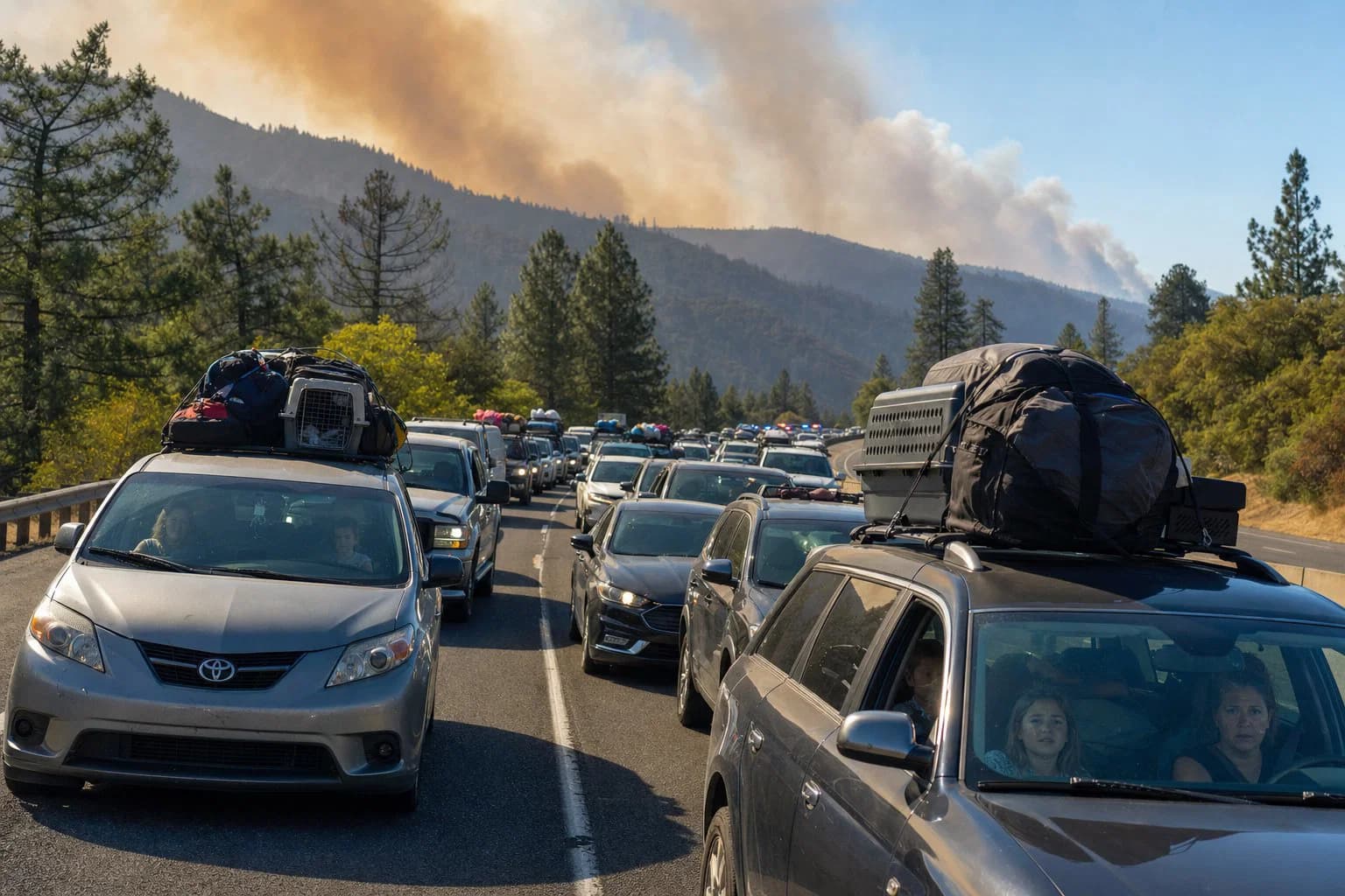
The primary cause of vehicle-related fatalities during wildfires is the loss of mobility. When thousands of residents attempt to funnel onto a limited number of arterial roads simultaneously, the transportation network suffers a catastrophic failure.
The Anatomy of Evacuation Gridlock
During the 2018 Camp Fire, the evacuation of Paradise demonstrated the fatal consequences of traffic bottlenecks. Vehicles evacuating down the limited mountain corridors experienced severe congestion, trapping motorists in the path of the advancing flame front. Similarly, the Woolsey Fire forced the complete closure of the US 101 freeway from Reyes Adobe Road to Mulholland Drive, as well as significant portions of the Pacific Coast Highway. When primary highways are closed due to flame impingement or heavy smoke, secondary routes instantly reach "oversaturation," a state where traffic flow completely ceases.
Research conducted on traffic flow during simulated emergencies indicates that distracted driving—frequently caused by panicked motorists attempting to text or call family members while moving—further exacerbates congestion. Drivers exhibit greater fluctuations in speed, change lanes less efficiently, and take significantly longer to react, resulting in a compounding delay across the entire traffic column. Even in day-to-day conditions, taking your eyes off the road for just a couple of seconds can be deadly, a risk explored in depth in The Danger of the Two-Second Glance: Risks and Solutions. In an evacuation, that same behavior can freeze hundreds of cars behind you.
The Science of Contraflow
To combat this gridlock, transportation authorities and law enforcement utilize a strategy known as "contraflow" (or lane reversal). Contraflow operations involve converting inbound lanes of a divided highway to handle outbound traffic, effectively doubling the capacity of the evacuation route. In California, the authority to activate contraflow operations lies with local authorities, emergency management agencies, and the California Highway Patrol (CHP).
During the Camp Fire, CHP Special Response Teams (SRTs) observed that local law enforcement resources were completely overwhelmed and unable to manage the volume of evacuating vehicles. CHP deployed air assets to identify critical choke points from above. On the ground, SRT squads executed a rapid contraflow operation on State Route 99, reversing the traffic lanes and creating free-flowing movement that mitigated life-threatening congestion.
However, contraflow is not a perfect solution. It requires immense manpower, meticulous intersection control, and perfect coordination to prevent catastrophic head-on collisions. Current evacuation simulation models highlight both the efficacy and limitations of various transportation responses. A study analyzing empirical data from the 2017 and 2018 California wildfires tested hypothetical evacuation variables in the wildland-urban interface (WUI) of Berkeley, California.
| Evacuation Strategy Tested | Impact on Total Exposed Vehicles in Fire Zone | Impact on Evacuation Time Estimates (ETE) |
|---|---|---|
| Reducing to 1 Vehicle per Household | Reduced by > 50% | Reduced by ~ 30% |
| GPS-Enabled Rerouting (50% adoption) | Reduced by > 50% | Reduced by ~ 30% |
| Phased Evacuations (Time-staggered) | Reduced by > 90% | Slight increase in overall ETE |
| Limited Contraflow (Resource Constrained) | Reduced by ~ 50% | No significant reduction in ETE |
| Extended Contraflow Operations | Significant reduction | Significant reduction in ETE |
The data confirms that the most effective way for a community to survive an evacuation is to minimize the number of vehicles on the road by carpooling to one vehicle per household. Additionally, adhering to phased evacuation warnings—allowing those in the most immediate danger to depart first—drastically reduces the number of vehicles trapped directly in the fire frontier.
The Role of Law Enforcement
The burden of executing these massive traffic maneuvers falls heavily on the California Highway Patrol and local sheriff's departments. During major incidents, the CHP initiates tactical alerts, canceling days off and deploying officers on grueling 12-hour shifts. Beyond traffic management, these Special Response Teams are tasked with securing evacuated zones to suppress crime, specifically targeting unauthorized entry and post-disaster looting.
The presence of law enforcement in these vulnerable, smoke-filled neighborhoods is critical for maintaining order, but it also underscores a vital safety principle: residents must heed evacuation orders immediately. Every officer assigned to force a reluctant homeowner out of a danger zone is an officer removed from critical traffic control duties, slowing down the evacuation for the entire community.
Technology on the Front Lines: Connecting Drivers in Crisis
In the frantic hours of a mass evacuation, traditional technology frequently fails. Standard routing algorithms (like those used by common map applications) are designed for normal commuting patterns, not for dynamic disasters where a clear road can become a wall of flames in a matter of minutes. Furthermore, cellular networks routinely become overloaded by call volume or are physically destroyed by the fire, leaving evacuees isolated in a sea of gridlock.
The next evolution in evacuation safety lies in decentralized, peer-to-peer driver communication and community-driven technology. This is where platforms like Carszy are fundamentally altering the landscape of roadside safety. Built as a driver-to-driver communication and community safety platform, Carszy utilizes license plates as unique identifiers, allowing motorists to connect directly with one another on the road without exchanging personal phone numbers or compromising privacy.
Shifting from Social Media to Human Media™
During a wildfire evacuation, peer-to-peer capability becomes a critical lifeline. If a motorist observes a dangerous hazard—such as sparks flying from the undercarriage of a fleeing trailer, a tailgate left open in a panic spilling belongings onto the highway, or a downed tree blocking a blind curve ahead—they can utilize License Plate Messaging to instantly text or call the specific driver involved. This eliminates the reliance on delayed municipal alerts and empowers citizens to protect one another in real-time.
Furthermore, the platform's VOIS™ (Vehicle of Interest Search) acts as a community-driven alert system. In the chaotic aftermath of an evacuation, when families become separated and vehicles are lost in the shuffle of detours and road closures, VOIS™ mobilizes a network of observant, tech-savvy drivers to locate vehicles involved in critical incidents.
By operating on secure, US-based servers with a strict focus on privacy, the platform facilitates a shift from passive "Social Media" to actionable "Human Media™." This real-world impact promotes safer roads through direct accountability and mutual aid. When formal emergency services are stretched beyond their absolute limits, having a network of drivers communicating hazard data directly to one another reduces law enforcement response times and keeps the community moving safely.
Driving Through the Inferno: Real-Time Navigation and Safety
When forced to drive through an active wildfire zone, the environment becomes inherently hostile to both human physiology and mechanical engineering. Thick smoke drastically reduces visibility, rendering even the most familiar routes unrecognizable and treacherous. The combination of extreme temperature, moisture, dim lighting, and flying embers creates a highly disorienting atmosphere.
Best Practices for the Active Evacuation
If a driver is caught in the active zone of a wildfire, specific protocols must be followed to ensure the vehicle remains operational and the occupants remain conscious and capable of driving:
- Maintain Visibility: Before entering the vehicle, wipe down all windows, mirrors, and headlights. Dust and ash will immediately begin to accumulate and bond to the glass. Headlights and taillights must remain on at all times, regardless of the time of day, to ensure the vehicle is visible to other panicked drivers and heavy firefighting equipment operating in the smoke.
- Cabin Air Management: Inhaling smoke-filled air causes respiratory distress, impairs vision by irritating the eyes, and induces severe fatigue. Motorists must roll up all windows completely and close all exterior air vents. The vehicle's air conditioning system must be set strictly to the "recirculate" mode to prevent toxic outside air and embers from being drawn into the cabin. It is recommended to briefly switch the system off every hour to allow the air filter to remove contaminants, though this may not be feasible during a rapid burnover scenario.
- Speed and Following Distance: Panic induces an overwhelming desire to speed, but doing so in zero-visibility smoke frequently leads to multi-car pileups, which can completely block the only route to safety. Drivers must actively fight this urge and increase their following distance to a minimum of four to six seconds, treating the road conditions with the same extreme caution as severe winter black ice. This kind of disciplined spacing and smooth braking is the same skill set that prevents crashes on steep grades, as discussed in Mountain Driving Safety Tips for Descents and Brake Use.
- Avoid Water Channels and Valleys: Drivers should anticipate severe visibility drops when dipping into valleys, creek beds, or low-lying drainages where heavy smoke naturally settles. Furthermore, recent burn scars are highly susceptible to flash flooding and rapid debris flows. Motorists must remain hyper-vigilant of the terrain and never attempt to drive around barricades or through moving water.
The Nightmare Scenario: Surviving Vehicle Entrapment and Burnover
The most terrifying prospect of a wildfire evacuation is vehicle entrapment—the moment when traffic ceases to move, the road ahead is blocked by debris or fire, and the flame front rapidly surrounds the vehicle. This phenomenon is known as a "burnover."
When faced with a wall of approaching fire, the primal instinct for many is to abandon the vehicle and flee on foot. This is almost universally fatal. Attempting to outrun a wildfire on foot exposes the fragile human body directly to extreme convective heat, radiant heat flux, and a lethal lack of oxygen.
Scientific observations and post-incident analyses unequivocally prove that a sealed, metal vehicle offers a significantly higher chance of survival than the open air. The steel body of the car acts as a physical "heat sink," absorbing and deflecting the initial blast of radiant heat that would otherwise instantly incinerate exposed skin. Research conducted by the CSIRO (Commonwealth Scientific and Industrial Research Organisation) in Australia on civilian passenger vehicle burnovers highlights the exact mechanics of surviving this ordeal.
The Mechanics of a Vehicle Burnover
A bushfire burnover generally consists of three distinct phases: the approach phase (where radiant heat is the main threat), the flame immersion phase (where direct flame contact occurs on the vehicle's exterior), and the receding phase (where the fire passes and the radiant heat load subsides). A standard civilian passenger vehicle cannot sustain prolonged flame immersion without catastrophic failure, but it can provide a tenable environment just long enough for a fast-moving grass or forest fire to sweep past.
During a burnover, temperatures outside the vehicle will reach lethal, unimaginable extremes. Studies indicate that the survivability threshold for human beings exposed to a short blast of hot air is roughly 200 degrees Celsius, and the threshold for short-term direct radiant heat is 2 kW/m². Inside the vehicle, the glass windows will block approximately half of the incoming radiant heat, but the remaining heat penetrating the glass can still cause severe, life-threatening burns to exposed skin.
As the heat intensifies, several alarming mechanical and chemical failures will occur. The petroleum-based plastics, adhesives, and sound-deadening materials within the dashboard, roof lining, and door panels will begin to volatilize, producing a thick, highly toxic "witches brew" of smoke inside the cabin. Modern plastic fuel lines and lightweight polypropylene gas tanks may melt under sustained heat, though metal gas tanks rarely explode.
If the heat differential between the inside and outside of the cabin becomes too extreme, the tempered glass windows may shatter, instantly exposing the occupants directly to the external fire and toxic gases. Furthermore, as the fire consumes all available oxygen in the immediate vicinity to sustain combustion, the vehicle's engine will become "oxygen starved" and stall. Motorists hoping to wait out the initial blast and then speed away must be prepared for the reality that the engine will likely not restart.
The Protocol for Surviving Entrapment
Despite these terrifying realities, staying inside the vehicle remains the only viable option for survival. If entrapment is inevitable, the following steps must be executed with absolute precision and discipline:
- Position the Vehicle Strategically: Do not park over dry, fine fuels like tall grass or brush. Low-level flame contact from beneath the vehicle will quickly ignite the undercarriage and breach the cabin. If possible, park on a clear road cut, a paved shoulder, a dirt pull-out, or a ditch away from heavy timber and heavy brush.
- Orient the Vehicle: The CSIRO studies indicate that facing the front of the car directly toward the approaching fire is structurally superior to a side or rear orientation, offering the best aerodynamic and structural deflection of the heat.
- Seal the Cabin: Roll up all windows completely, close all air vents tightly, turn off the air conditioning, and shut the engine off to prevent it from drawing in smoke. Turn the headlights and hazard lights on so the vehicle remains visible in the dense smoke to rescue crews, just as you should during any serious roadside incident or breakdown, a topic explored further in Roadside Survival: New Safety Strategies for Drivers in 2026.
- Take Cover Below the Windows: The most critical physical action is to get below the level of the windows. In most fuel types, temperature and radiant heat flux increase with height. Getting on the floorboards shields the occupants from the direct line of sight of the radiant heat passing through the glass.
- Deploy the Wool Blanket: Occupants should cover themselves entirely with a heavy wool coat or a pure wool blanket (which must be a mandatory item in the vehicle's Go-Bag). Wool is naturally fire-resistant and will provide a vital thermal barrier against the radiant heat and protect against dripping, volatilizing plastics inside the cabin. Synthetic blankets must be avoided entirely.
- Protect the Airway: Keep your face as close to the floor as possible to protect the respiratory system from the toxic smoke filling the upper space of the cabin. Stay on the floor and under the blanket until the roaring sound of the main fire front has passed completely, and the temperature begins to drop.
It is worth noting that modern wildland fire engines are equipped with advanced crew protection systems, including personal radiant heat shield blankets, external water spray deluge systems, and drop-down radiant heat shielding for the windows. Civilian vehicles possess none of these specialized safeguards, emphasizing exactly why early evacuation is vastly preferable to testing the thermal limits of a standard passenger car.
The Future of Evacuation: Autonomous Vehicles and V2I
Looking forward, the integration of Connected and Autonomous Vehicles (CAVs) presents a promising frontier for emergency evacuation planning and traffic management. The massive traffic jams witnessed during the Camp and Woolsey fires are largely the result of uncoordinated human behavior—reaction delays, phantom traffic jams, distracted driving, and panicked route selection.
Recent research into regional emergency evacuations highlights that data from connected vehicles can be utilized to accurately predict and estimate traffic delays in real-time. By analyzing driving behaviors, hard braking events at critical intersections, and traffic conditions during simulated wildfire scenarios, researchers are laying the groundwork for intelligent transportation systems that actively manage the flow of fleeing vehicles, optimizing the network to push the maximum number of cars out of the danger zone.
In urban environments, Vehicle-to-Infrastructure (V2I) communication is already being rigorously tested to prioritize the movement of emergency vehicles. By utilizing visual sensing, sound sensors to detect sirens amidst urban noise, and artificial intelligence, intelligent intersections can automatically adjust traffic signals to create "green corridors" for fire engines and police cruisers, reducing response times by up to 30% without disrupting the overall flow of traffic.
As this technology scales to the civilian level, a mass evacuation could theoretically be managed by a centralized AI that communicates directly with autonomous vehicles, pacing them to prevent the "oversaturation" of exit routes and dynamically rerouting them away from rapidly expanding fire perimeters.
Conclusion
The reality of living in California's beautiful but volatile wildland-urban interface is that the question is not if a wildfire evacuation will occur, but when. The catastrophic losses experienced during mega-fires serve as a permanent reminder that the state's roadways are deeply vulnerable to sudden, mass-scale panic.
Surviving a wildfire evacuation requires a fundamental paradigm shift from passive reliance on authorities to active, educated preparedness. Motorists must understand the absolute urgency of an Evacuation Warning, meticulously prepare their vehicles with a half-tank of gas and a comprehensive Go-Bag, and mentally rehearse the grim but necessary steps required to survive a vehicle burnover. Furthermore, adapting to modern community safety platforms allows drivers to share vital, real-time intelligence when official channels inevitably lag behind the speed of the flames. Parents of young or newly licensed drivers should also think beyond evacuation days: the same thoughtful planning that keeps teens safe on everyday trips—covered in Smart Strategies to Keep Teens Safe in Their First Car and Keys to Calm: Teaching Teens to Drive Without Panic—can make the difference when a fire suddenly turns the routine school run into an emergency escape.
Do not wait for the smoke to block the sun before making a plan. Prepare your vehicle, map your routes, and download the Carszy app to stay connected with the surrounding community, utilizing license plate messaging to protect fellow motorists and ensure that no vehicle goes unaccounted for when disaster strikes. If your evacuation plan involves an electric vehicle, take time now to understand charging behavior, range in extreme weather, and charger etiquette during high-demand events, and review how to manage EV range anxiety so you’re not learning those lessons for the first time with flames on the ridgeline.
Frequently Asked Question
What is the difference between an Evacuation Warning and an Evacuation Order, and when should I actually leave?
An Evacuation Warning (sometimes called an Advisory) means there is a potential threat to life and property in the area. While the danger is not yet imminent, conditions can worsen rapidly. This is the exact time to gather family members, load your pre-packed emergency supplies into the vehicle, and prepare to leave. If you require extra time to mobilize—such as having mobility issues, small children, or large animals—you should leave immediately during the Warning phase to avoid traffic gridlock.
An Evacuation Order means the danger is imminent and there is an immediate threat to life. It is a lawful order issued by law enforcement to leave the area right now. Public access to the area is closed, and you must depart instantly without taking time to gather belongings. Failure to leave during an Order puts your life, and the lives of the first responders who may have to rescue you, in grave danger. If you wait for the Order to leave, you will likely be caught in severe traffic.